

Ripplebrook Backroads showcases some of the deeper zones of the southwest quadrant of mount hood national forest. primitive forest path, flowy trails, serpentine doubletrack and inexplicable lost highway connects ripplebrook, timothy lake and the clackamas river in a sublime circuit of seemingly deserted byways and pristine river valleys.

Originally staged as a 2015 Unpaved ride event, Ripplebrook Backroads has been reimagined as a more singletrack-intensive affair, pushing things deeper into the thick needled duff that this quadrant does so well. Right out of the gate we want to mention that this pair of routes is going to be much smoother and more relaxed than prior courses in this year's series. Everything here is going to be CX bike accessible.
Kicking things off, we urge folks to use the west end of the parking lot and be respectful of not parking directly in front of the store. We'd like to be a welcome presence going forward, so thanks in advance for helping minimize the parking impact as best we can.
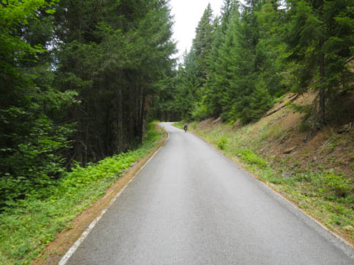
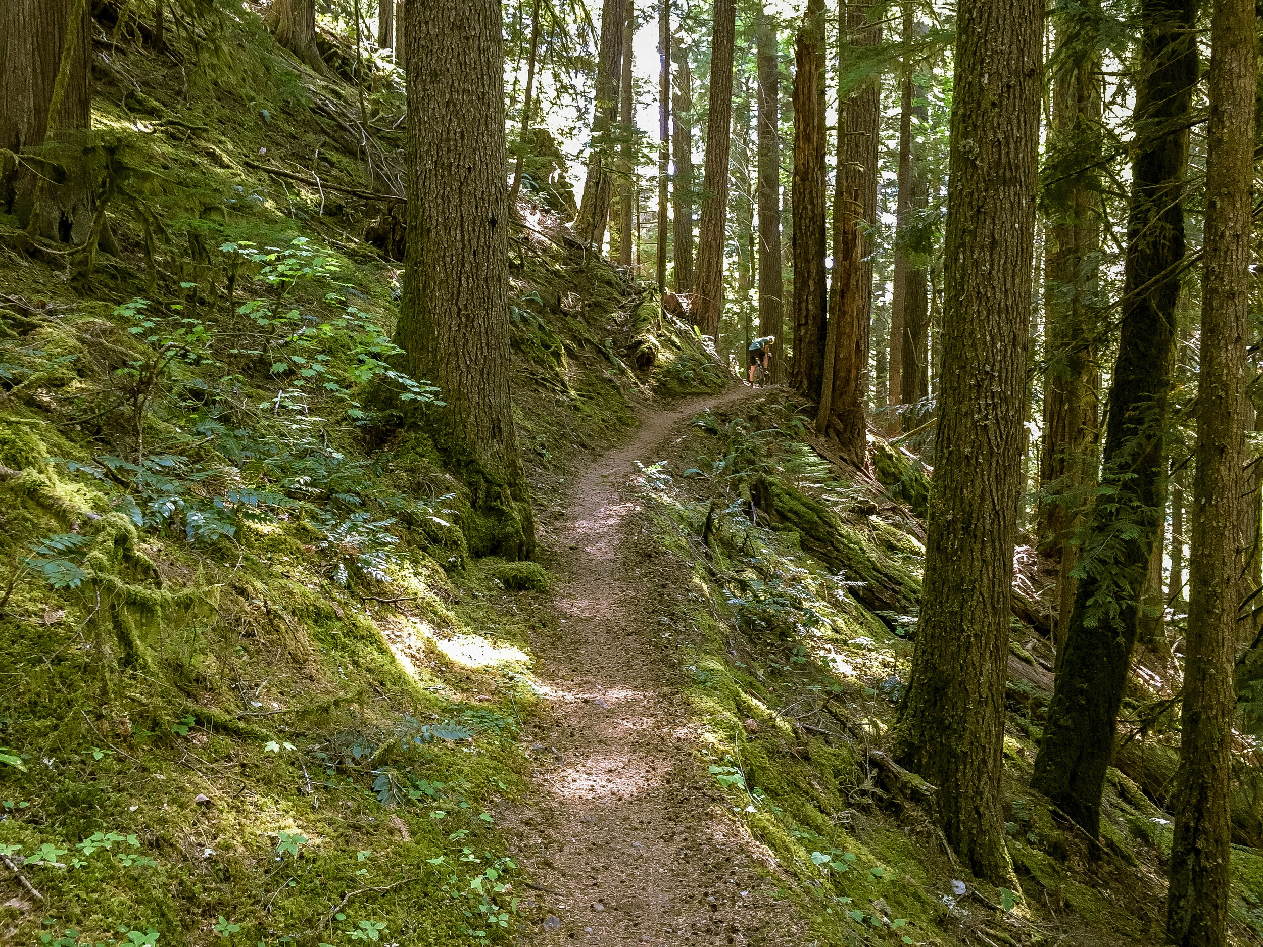
Things set off at the Ripplebrook store along Highway 224 about 25 miles southeast of Estacada. We head east up Ripplebrook Road/4630, skirting Lake Harriet before intersecting NF57 at mile 7 and gently climbing the remainder of the way to Timothy Lake. At mile 15.7 things scale down a bit as we jump onto Timothy Lake trail which circumnavigates the northwest side of the lake via silky luxuriant singletrack. At mile 19.8, the route 'technically' merges with the Pacific Crest Trail for 600 feet.

Dismount in deference to hiker hegemony or utterly schralp in sheer defiance of all that is prudent and lawful, the choice is yours. Just do what feels right.
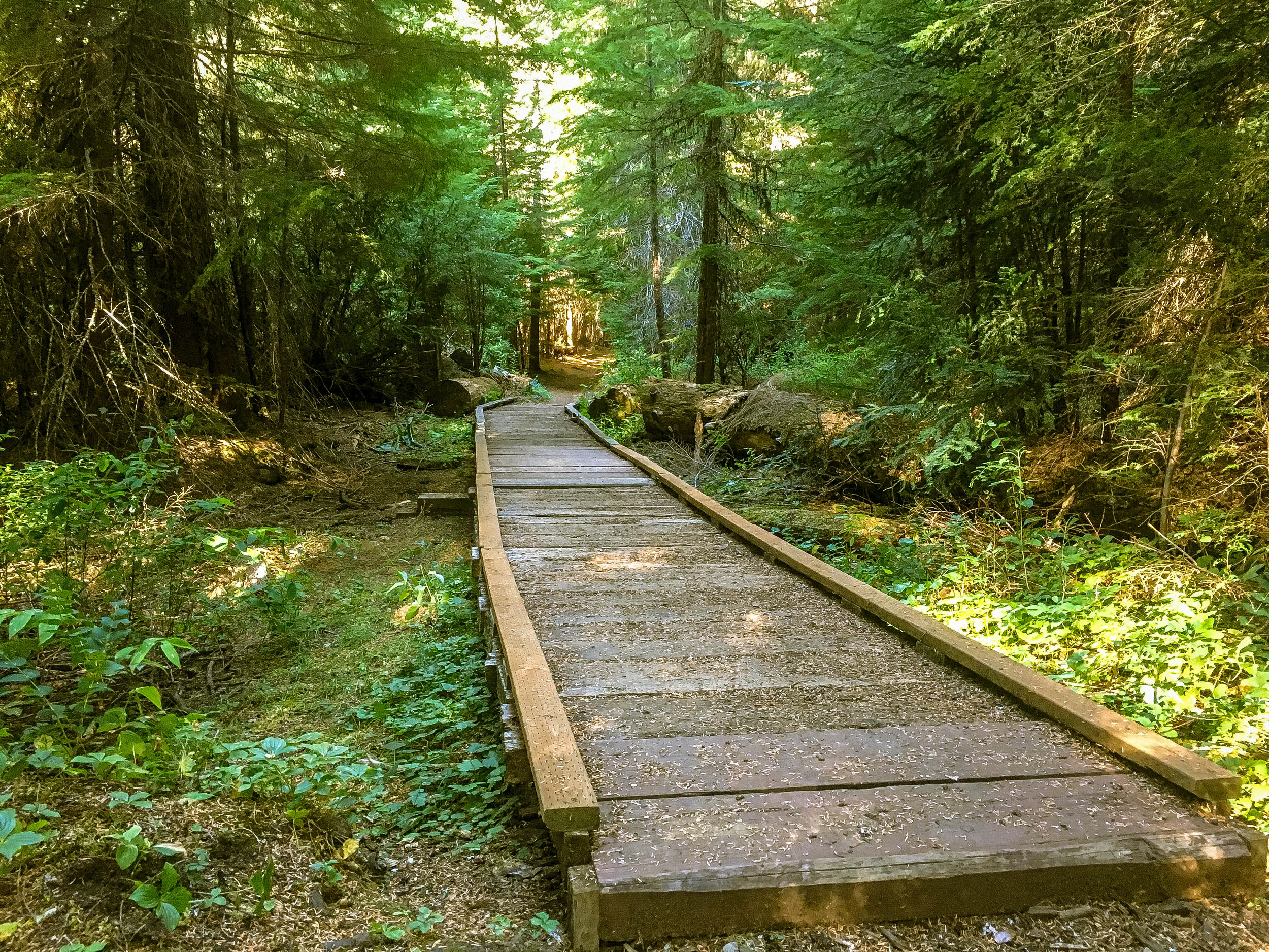
We keep to relatively straightforward singletrack until mile 24 where we intersect NF42 southward to the historic ranger camp at Clackamas Lake. There are two water sources here, the first of which is a fountain visible from 42, the other is a spigot in the center of the ranger camp. Be sure to explore the ranger camp on your way to connect w/ the Miller Trail northward to Timothy Lake Trail en route to the paved road 5740 southward. Keep alert for the left onto the gravel connector at mile 29.6 which begins a long, gradual climb to the Oregon Skyline Road at mile 32.3. Through this section, be aware you are very deep in the bush.


We were surprised by a black bear barreling down the trail this past weekend through this bit, so understand that this is part of the deal. These forests are healthy, wild, raw, remote and have an ample bear population.

Once we hit NF42, tuck in and enjoy the long, rollercoastering descent. One thing we have to stress is that while it may seem deserted out here, this stretch of road does experience a certain amount of auto traffic in both directions, so keep alert and don't assume you have the road to yourself when cooking blind corners. There very well may be cars coming in the opposite direction assuming the same thing.

EPIC VERSION
68.6 MILES
4815 FEET
ROUTE FORMAT: LOOP
SURFACE: 50% PAVED, 30% gravel, 20% singletrack
TIRES: 38C+
BIKE: CX, GRAVEL, ADVENTURE
FULL RIDE WITH GPS ROUTE + GPX FILE
SMOOTH VERSION
59.2 MILES
3914 FEET
ROUTE FORMAT: LOOP
SURFACE: 70% paved, 20% gravel, 10% smooth trail
TIRES: 28C+
BIKE: road, CX, GRAVEL, ADVENTURE
FULL RIDE WITH GPS ROUTE + GPX FILE
Terms of Use: As with each adventure route guide published on OMTM.CC, should you choose to cycle this route, you do so at your own risk.
1. The www.omtm.cc site and @omtm.cc Instagram account (collectively, the “Site”) are owned and operated by Our Mother the Mountain LLC (“OMTM”). The Site is primarily a creative project presented by OMTM and other contributors, but it is increasingly being used as a resource for other cyclists seeking challenging and compelling cycling routes. As such, we want to be clear about what the Site is and is not.
2. It is a creative project and may be used as (a) one resource (of many) for potential routes and (b) a source of inspiration for cyclists.
3. It is not designed to be a replacement for your own diligence and judgment. You should engage in significant additional diligence, and use your judgment regarding the route and your abilities, before embarking on any route described on the Site. You are solely responsible for obeying all public and private land-use restrictions and rules, carrying proper safety and navigational equipment, and following the #leavenotrace guidelines.
4. The information on the Site is for general information purposes only. While we made reasonable efforts to ensure the information was up-to-date and correct when it was posted, the information may be incorrect, incomplete, or outdated. We make no representations or warranties about the completeness, timeliness, accuracy, reliability, or quality of the information. Nor are we able to promise anything regarding weather, route conditions, or route availability. Everything is provided on an “AS IS” and “AS AVAILABLE” basis, and any reliance you place on information available through the Site is at your own risk.
5. Without limiting the foregoing, OMTM is not responsible for GPS content provided by third-party contributors or third-party sites or platforms (such as Discord, Google Groups, and Strava Club) that may be linked or referenced on the Site: we do not own or operate such sites or platforms and are therefore unable to vouch for any content on those sites or platforms.
6. Cycling is an inherently dangerous activity, and we are unable to control the actions of third parties (including without limitation other cyclists or users of the routes). As such, the Site is not designed (or able) to reduce or eliminate your risk of injury, death, or property damage. We assume no responsibility for injury, death, or property damage.
7. You and your heirs, personal representatives, and assigns, agree to indemnify, defend, and hold OMTM, its owner(s), and all OMTM contributors harmless from and against any claims arising out of or related to your use of the Site.