

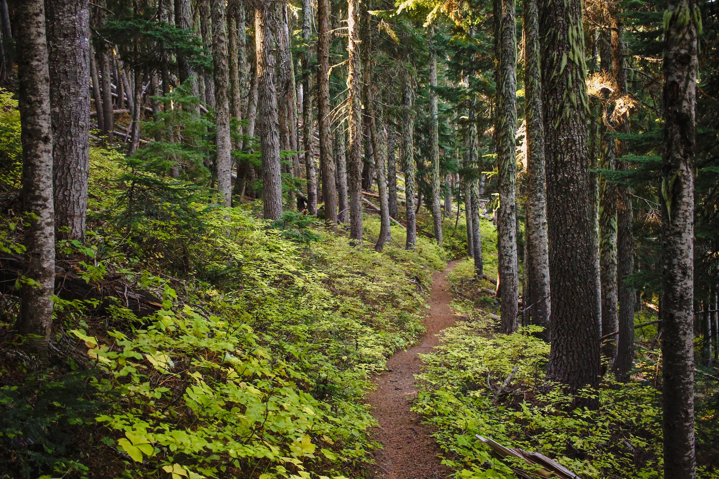
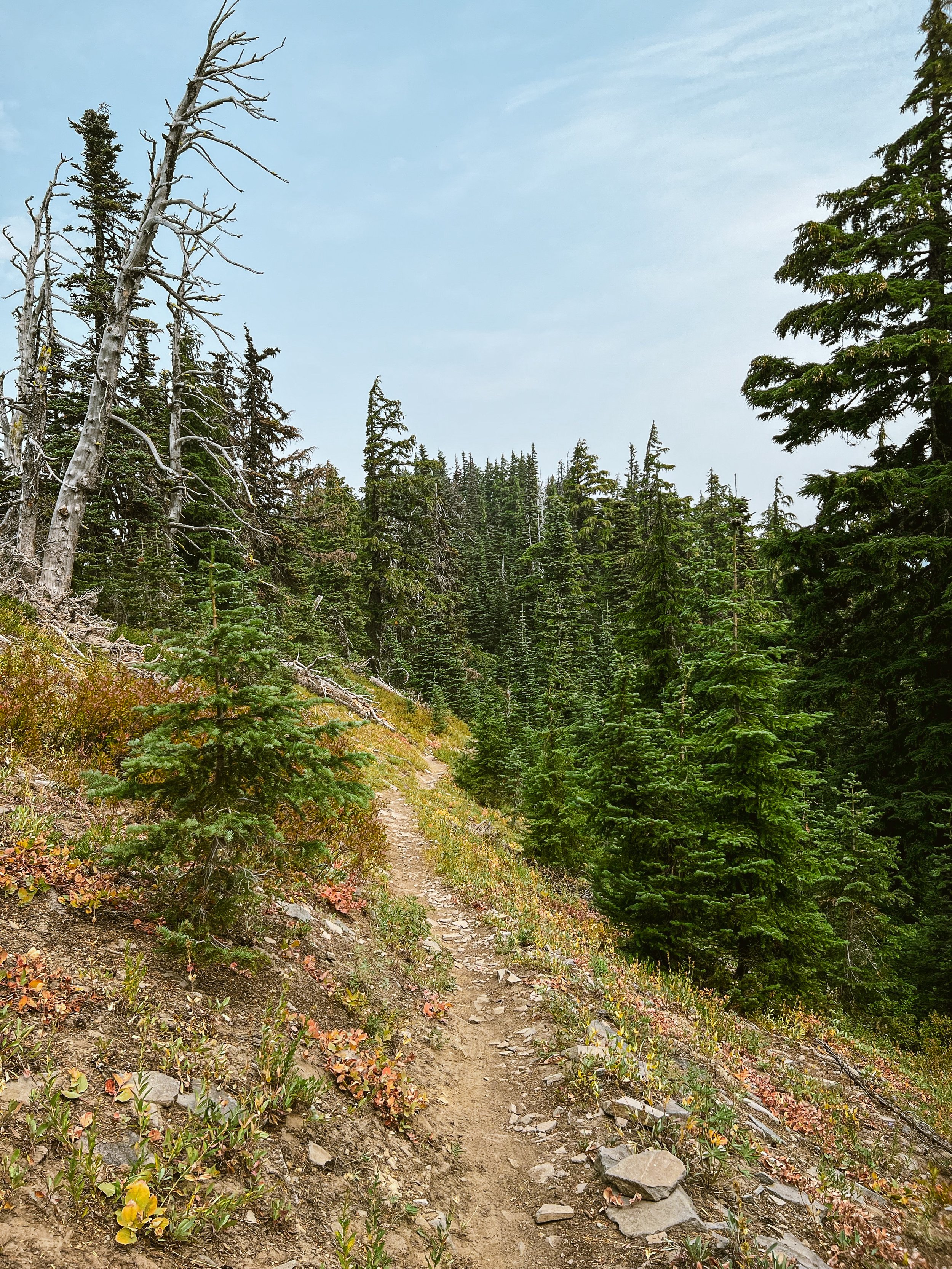
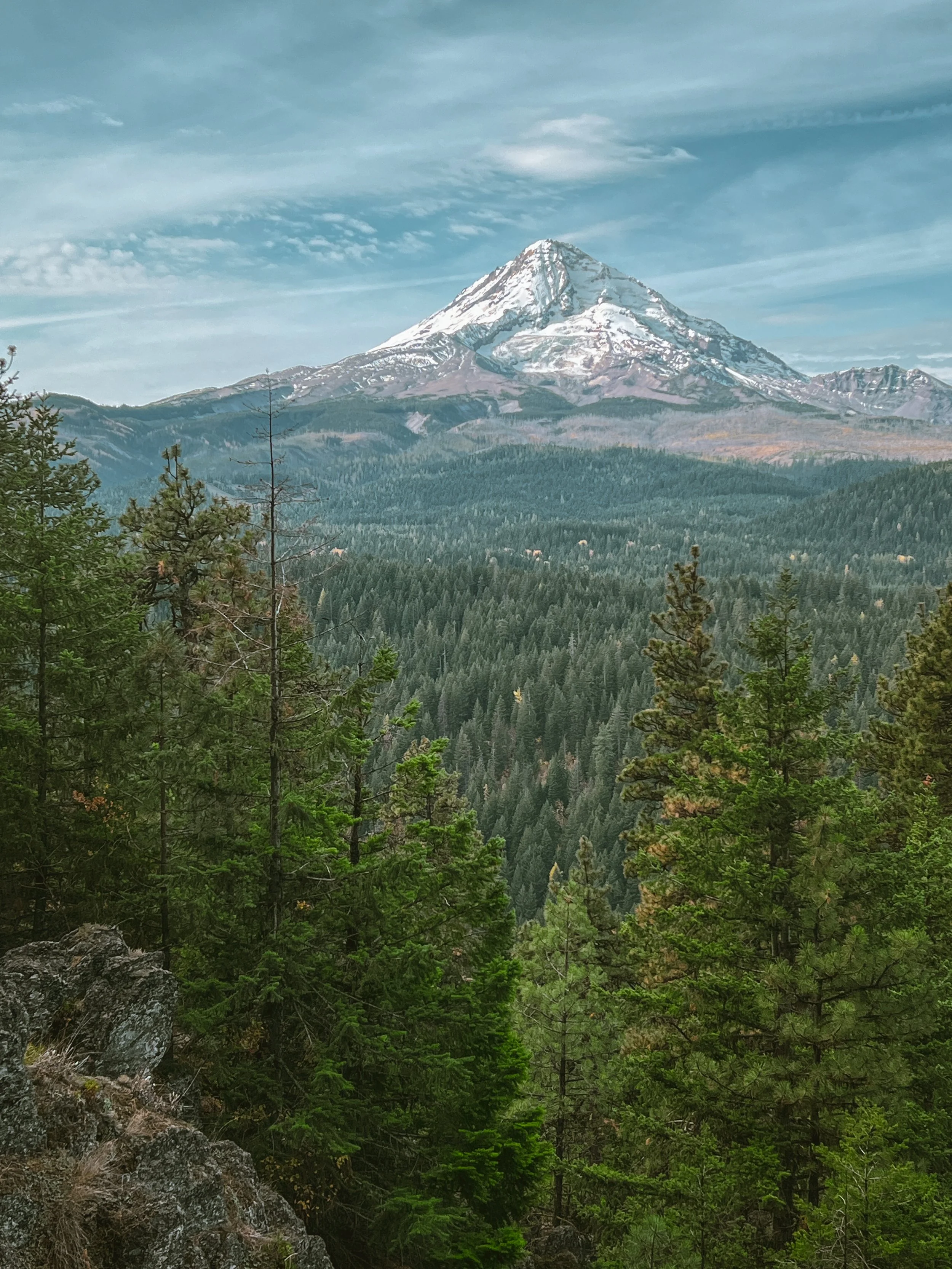
Rigorous. Raw. Remote. Challenging. Dynamic. Gunsight Butte is all these and more. This spectacular stretch of rocky, rooty ridgeline runs north-south through subalpine forest, windswept meadow, and cascading scree to link Bennett Pass with Gumjuwac saddle through the rugged heart of Mount Hood’s 44 high country. One caveat: it’s not particularly easy to get to. You’ll have to work for it.

Gunsight Butte Trail #685
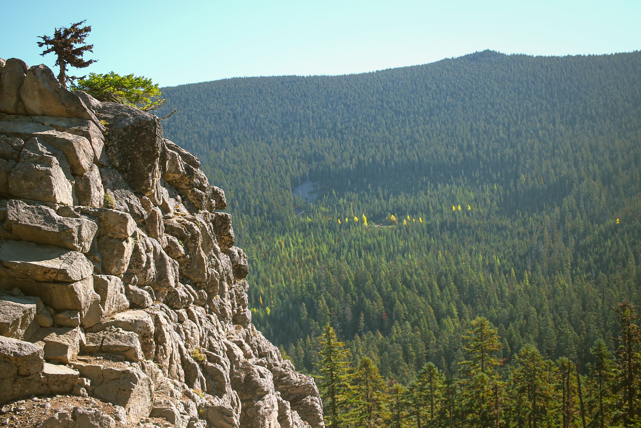
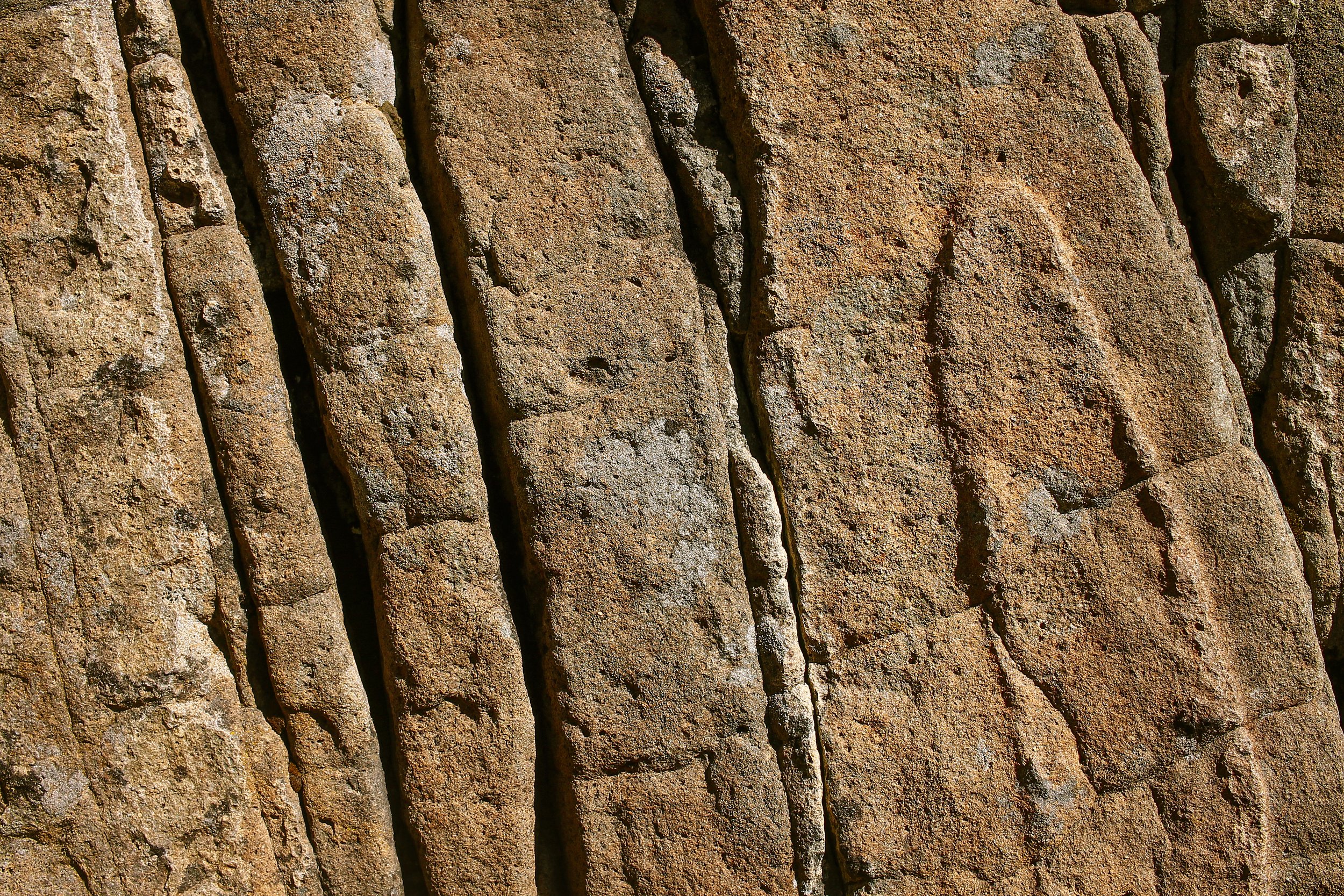
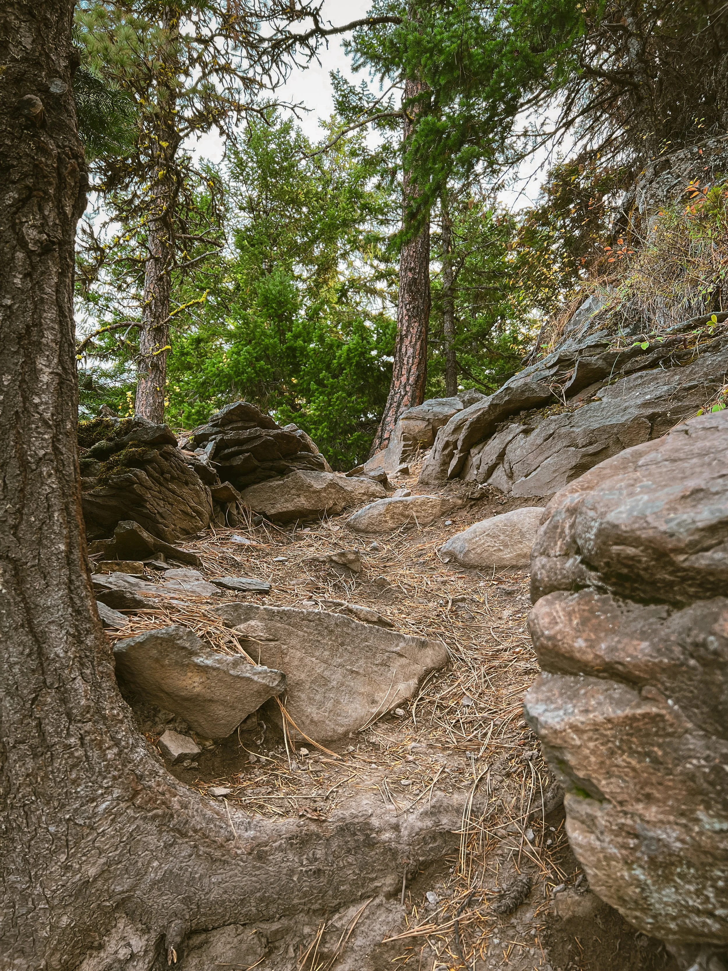
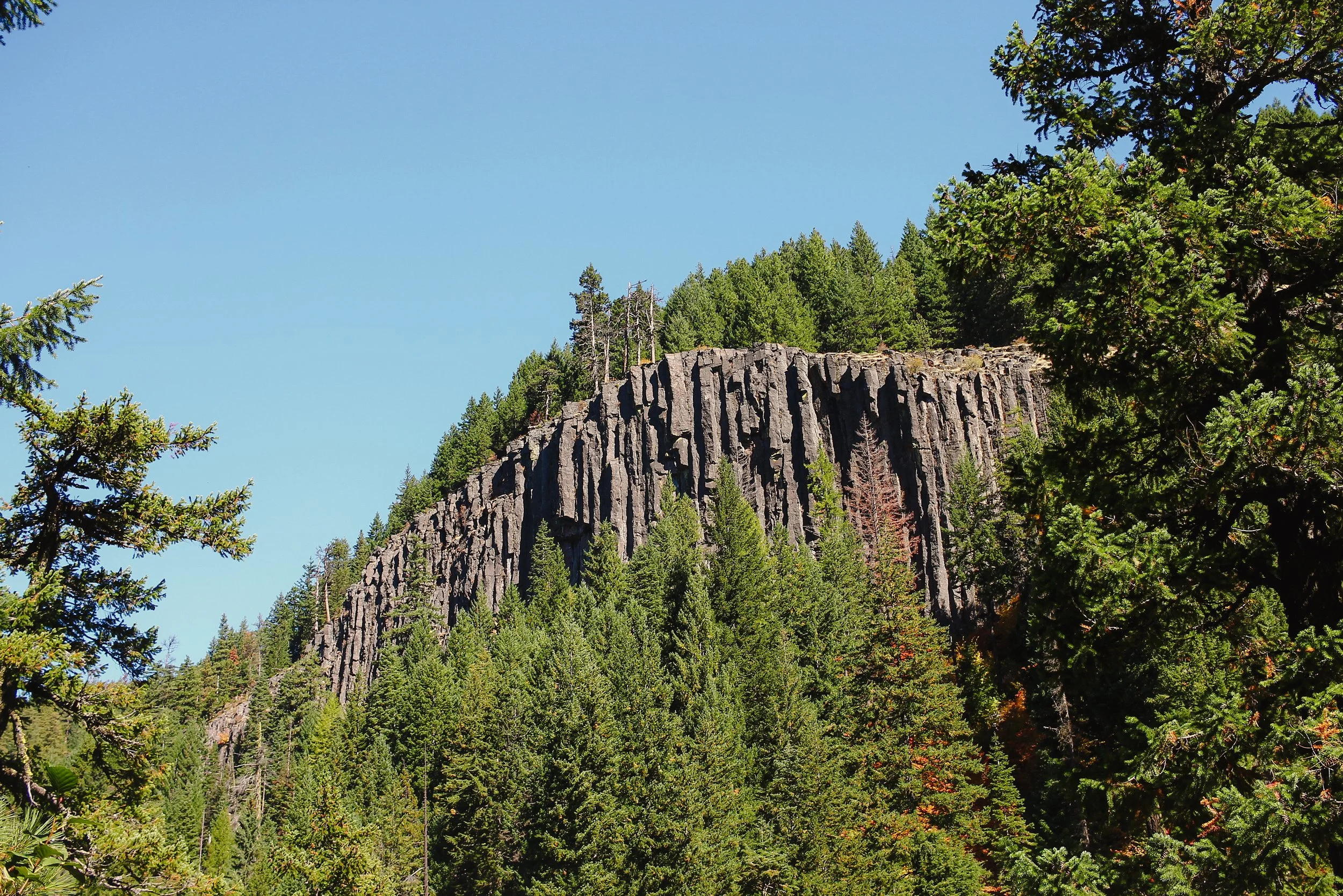
Gunsight Butte is our favorite kind of trail – the type that exist wholly unto themselves. Backcountry corridors which start and finish deep in the good stuff without much fanfare, infrastructure, or trailheads. Just a path leading off into the woods. This uncut gem dips in and out of subalpine forest and open meadow, gaining 820 feet over 5 miles. Its tread alternates between rich chocolate cake, basaltic shale, and velvety needled duff, peppered with pitchy climbs with embedded root and rock features. The trail is punctuated by several craggy outcrops and fields of open scree – isolated slides of tumbling rock bearing a faint impressionistic through-line. If you listen carefully, the sound of rubber over loose andesite creates a hollow, percussive clink like a woozy marimba.

Gunsight four ways
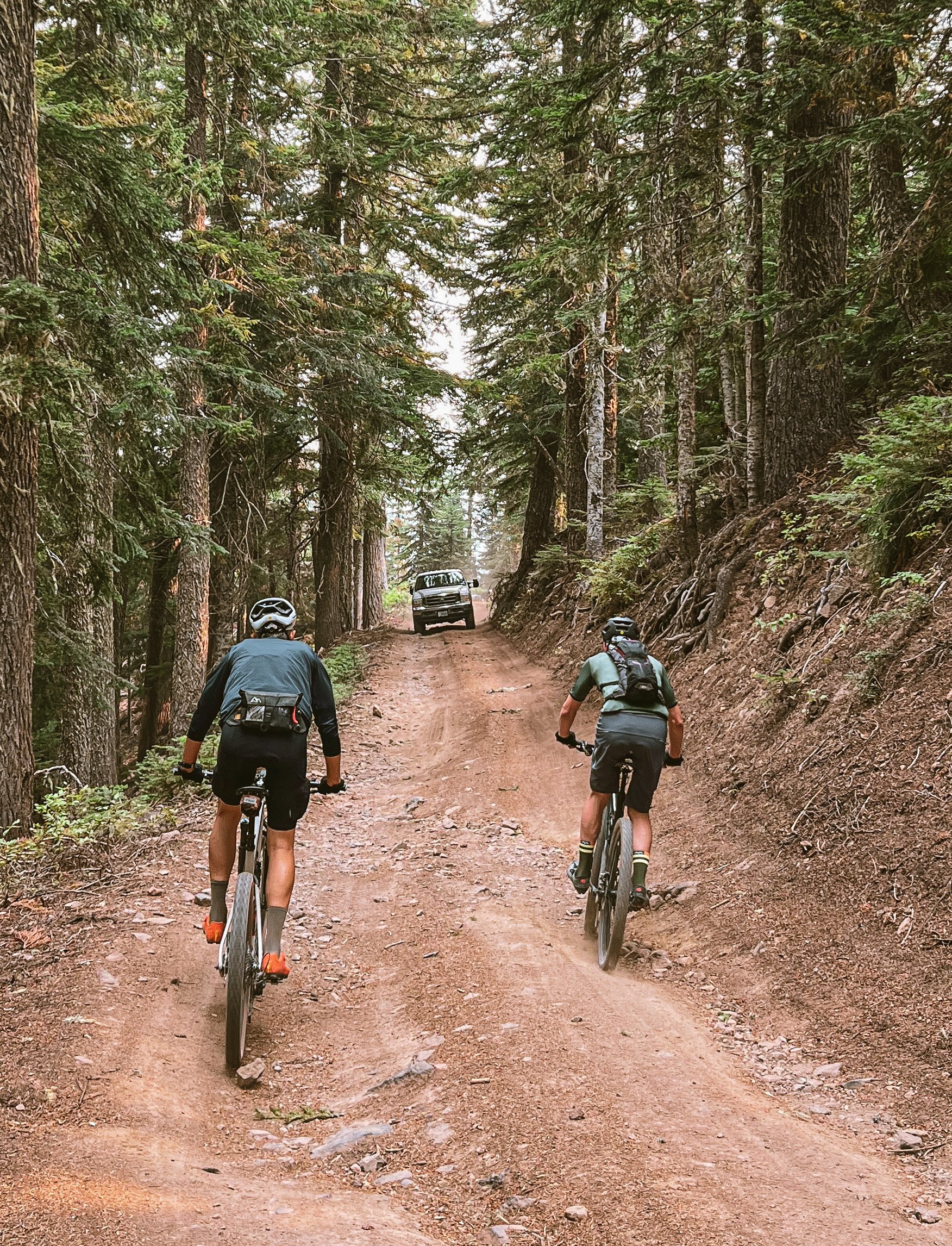
Because Gunsight Butte is a short, point-to-point backcountry trail, it makes the most sense built into a larger ride. Some folks like to shuttle from Bennett Pass to popular descents like Dog River or Surveyor’s Ridge. My preference is generally to loop it into a bigger backcountry mountain bike day via one of three configurations presented below. Each has its own distinct flavor and flow. One starts by climbing Dog River for a gradual ascent into the 44. Another drops Cooks Meadows to Dog River to climb the highly underrated East Fork trail. The third traverses Lookout Mountain, Cedar Creek, and Fifteenmile. The fourth – and new addition care of Tom Jeanne begins at Pocket Creek Sno Park, climbs past the start of Gunsight and heads south for a big loop through the Boulder Creek drainage before returning to finish with Gunsight and Gumjuwac trails. Make no mistake, these are all fairly hefty, full-spectrum mountain bike days over steep and challenging terrain. This is not tailored for underbiking. Respect the terrain. They will take longer than the numbers suggest, so budget your nutrition, energy, and daylight accordingly.

1. gunsight Butte: dog river to east fork
A couple things about this clockwise orientation: the climb is an absolute stunner. If you like long, sustained 5800 foot cross-country climbs, Dog River is a fantastic escalator into the 44 high country. Bear in mind, this is not everyone’s cup of tea. A lot of riders prefer the downward direction. This version leans into the up, so it’s something to consider. Dog River meanders hillsides of garry oak and evergreen with isolated bits of rocky tech before connecting to Surveyor’s and Cooks Meadows. It’s gentle enough, but all that elevation does add up. Over the hump of Lookout Mountain, the southernmost stretch employs the wild and wonderful 3550, a rowdy primitive Jeep track paralleling Gunsight Butte, which returns north to Gumjuwac saddle for a steep, angular thrillride into the valley below.


east fork TRAIL #650
The fun doesn’t stop here. Across Hwy 35, we enter an enchanted world. Welcome to the East Fork. You will encounter the roadbed-meets-watercourse of 3520, an access road whose conjoined path with Robin Hood creek traverses 2 miles of rocky washouts, bogs, and brushy creekbed. It is easy to miss the drop into East Fork #650 at mile 31.6 so keep alert. East Fork trail is second only to Gunsight itself as the highlight of the day. 4 miles of undulant buffed-out bliss skirts the highline above the Hood River’s east fork. The shady bench cut rolls, dips, dodges, twists, and turns ever downward but is not without a handful of punchy climbs. The final 4 miles along 35’s generous shoulder gently returns riders back to the Dog River trailhead.
39.7 MILES
6295 FEET
ROUTE FORMAT: LOOP
SURFACE: 60% singletrack, 30% Primitive jeep track, 10% paved
TIRES: 2.3” knobbies minimum. TUBELESS HIGHLY RECOMMENDED
BIKE: mountain bike/HARDTAIL/XC/trail bike
SERVICES: nope
FULL RIDE WITH GPS ROUTE


2. gunsight Butte: Bennett Pass to east fork
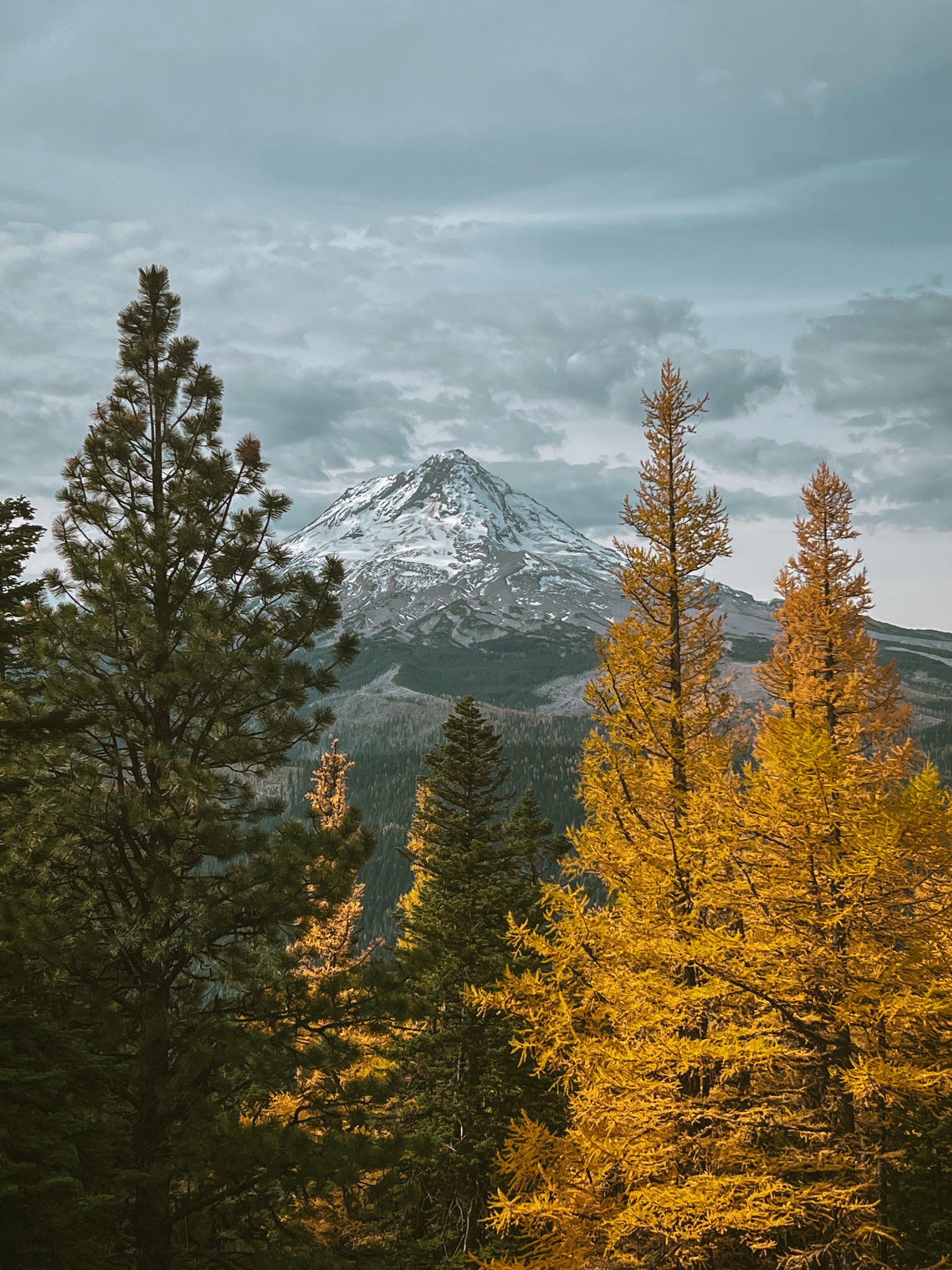
This counterclockwise edition tends to be the favorite, offering some distinct advantages. The first being an ample warm up through the hallowed Gates of Chunder, a regional rite of passage for the seasoned aventurier de l'arrière-pays. Additionally this orientation puts Gunsight front and center on fresh legs for maximal satisfaction. The Jeep trail to Lookout Mountain trots out all the superlatives: most badass mountain views and roughest-yet-most-satisfying-road-climb among them. This drops into 10 miles of sinuous descending via Cooks Meadows to Surveyor’s Ridge to Dog River to 35. This is easily one of the best lines in the area, showcasing the breadth and bombast of the 44 system.

Now the hard part. Take a look at the elevation profile and you’ll notice a V-shape. That means whatever goes down has to climb back up again. It is a steady 3000 feet back to Bennett Pass, but much of that is buffered by the sumptuous enchantment of the East Fork. The smooth, serpentine bench cut rolls ever-upward beneath dense evergreen, tracing the east fork of the Hood River to connect with 3520, a washed-out utility corridor leading to 35 and the Pocket Creek sno-park. The final push closes the loop by climbing above Pocket Creek. Expect moderate but escalating gradients near the top before rejoining 3550 for a 3-mile gravel cooldown back to Bennett Pass. Rejoice!
45 MILES
6591 FEET
ROUTE FORMAT: LOOP
SURFACE: 70% singletrack, 30% Primitive jeep track
TIRES: 2.3” knobbies minimum. TUBELESS HIGHLY RECOMMENDED
BIKE: mountain bike/HARDTAIL/XC/trail bike
SERVICES: nope
FULL RIDE WITH GPS ROUTE


3. gunsight Butte: cedar creek to fifteenmile
This is the big one. I mean they’re all big – but this one is a bona fide epic. Looping in four of the most rugged and dynamic trails in the 44 (Gunsight, Lookout Mountain, Cedar Creek, and Fifteenmile), this plucky brawler puts your backcountry chops on notice. This variant also starts at Bennett Pass like the previous loop but veers east to Fifteenmile for a ride of a different flavor. Highlights here include the rich, rooty chocolate cake of Lookout Mountain, the rocky pulpit of Eightmile Point, and arid, grassy ridges, meadows and forested lowlands of the Fifteenmile.
42.9 MILES
6618 FEET
ROUTE FORMAT: LOOP
SURFACE: 60% SINGLETRACK, 40% PRIMITIVE JEEP TRACK
TIRES: 2.3” KNOBBIES MINIMUM. TUBELESS HIGHLY RECOMMENDED
BIKE: MOUNTAIN BIKE/XC/TRAIL BIKE
SERVICES: NOPE
FULL RIDE WITH GPS ROUTE


cedar creek // fifteenmile #456
This loop is the stuff of legend. Upper Fifteenmile drops riders into Cedar Creek to traverse satisfying lines of oak and pine forest, open grassy meadows, complex, craggy switchbacks and exposed ridgelines with steep, technical drops. Several open sections provide expansive views across the drainage to the north, dropping into densely-forested lowlands along Fifteenmile Creek. As you may have noticed, this route also has a pronounced V shape, the lowest point of which climbs out of Fifteenmile. It is long, slow, steep, hard, and absolutely beautiful. Pro-tip: refill your water by filtering at the Fifteenmile campground, it will be one of your last opportunities to do so.

The remainder of this route climbs primitive, rutted Jeep trail back over Lookout Mountain to roll 3550 all the way back to Bennett Pass. Keep available daylight and overall energy expenditure in mind if you’re planning to take this on. Start early and keep moving. The climb out will be harder and take longer than you expect. V-shaped routes become exceedingly difficult to get yourself out of should you crack, run low on food/water, or end up racing nightfall.


4. gunsight Butte: Pocket Creek to Boulder Lake
This fourth edition arrives care of good ride pal Tom Jeanne. Staging out of Pocket Creek Sno Park, this approach saves the rigors of Gunsight for the back end, instead heading south for a larger figure-8 loop through the Boulder Creek basin. We return via deep cut gem of the Forest Creek trail to finish by climbing Gunsight Ridge proper and descending Gumjuwac to wrap things up tidily. This backcountry mountain bike exploration consists of two significant climb and descent sequences but is squarely back-loaded, which means it is going to be harder than the numbers suggest. Take heed and plan for an all-day affair. Expect moderate scree gardens and mild sections of rocky, rooty tech descending into Boulder Lake. Crane Creek offers long stretches of tread less-traveled with spongey duff and lovely, deeply-forested valley singletrack. The long gradual climb out along the old 4880-013 roadbed and Forest Creek trail navigates smooth, brushy, slightly arid lines up through charred sections of recovering burn along the rocky rim of the valley.

highlights
Starts with a long climb; good pavement at a gentle grade on NF 3540 soon gives way to an ever steeper gravel climb on NF 640 and 641, reaching a 15% grade for the last push to a nice viewpoint of Mt Hood's SE aspect.
From there, a chunky gravel traverse to Bonney Meadows Campground, where you'll hop on the Boulder Lake Trail #463 which descends through one of the largest talus slopes in the area.
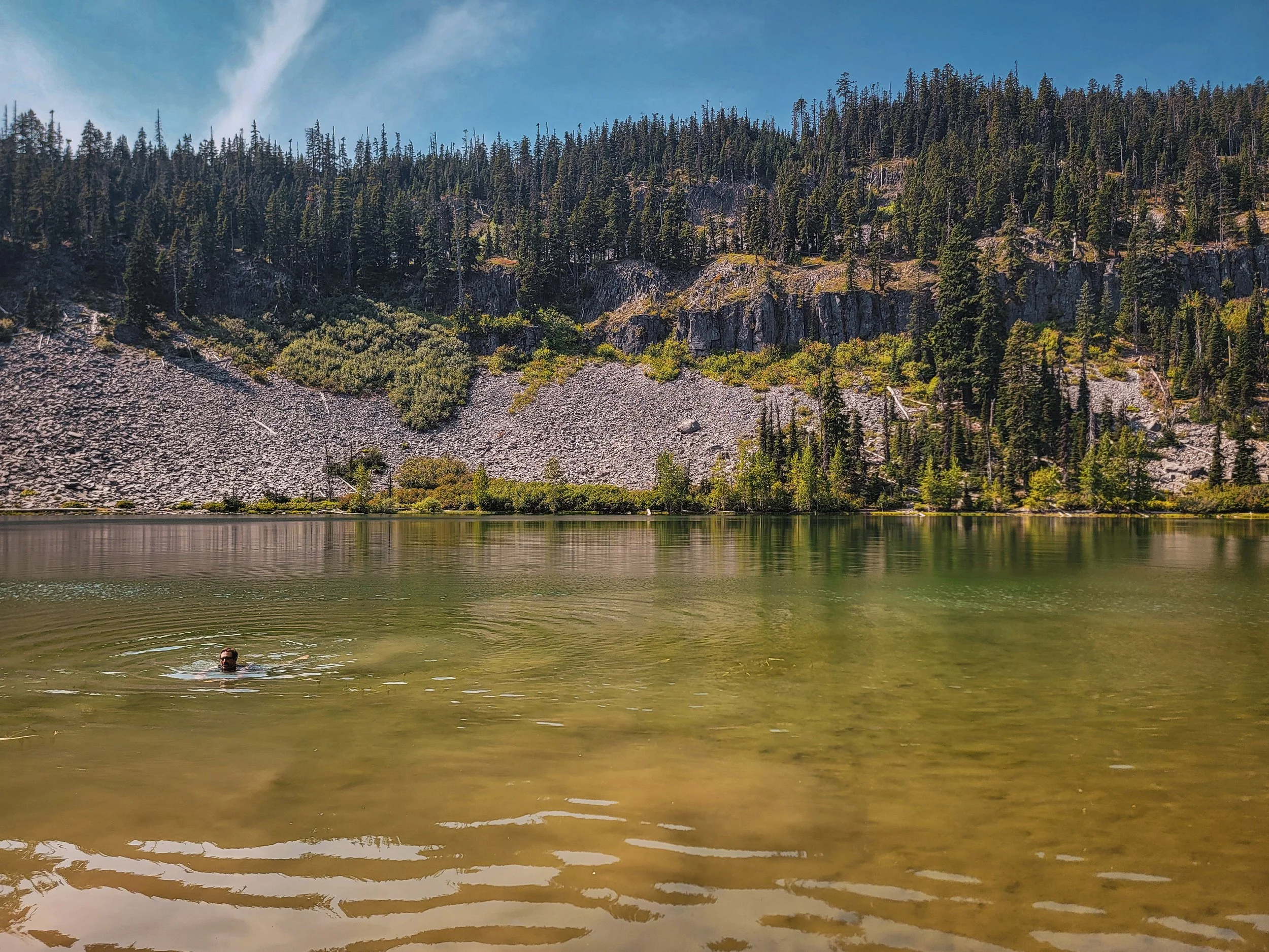
Sitting at nearly 4600' elevation with a backdrop of andesite cliffs and scree, Boulder Lake makes for a nice rest stop and perhaps a dip.
Continue downhill on the trail across NF 4880 and Boulder Creek, then head right on Crane Creek Trail #478, which heads slightly downhill on a fun romp through the forested creek valley, passing some very large Douglas-firs.

Just before another small talus field, cross Boulder Creek on a log near a small brown signpost lacking a sign. This can change from year to year, but as of 2024 there is a downed tree that is fairly easy to cross while pushing a bike along the creek bottom.
A trail leading from the west side of the creek becomes an old roadbed (NF-4880-013). Here begins the second, longest climb of the route, which is almost all trail. The trail here can become overgrown with thickets of snowbrush (ceanothus), which have a delightful scent but can be nearly impenetrable. Thankfully, trail work in 2024 cleared the brush.
Forest Creek Trail passes through the burn scar of the small 2023 Boulder Fire and along the rim of the slope seen earlier from the shore of Boulder Lake. Excellent views to the east.
After heading back through the campground and retracing the outbound traverse, hop on Gunsight Trail which is all the more challenging when tired.
The ride finishes with a fast descent on Gumjuwac Trail and a couple of miles on the highway back to the start.


28.9 MILES
4785 FEET
ROUTE FORMAT: LOOP
SURFACE: 70% SINGLETRACK, 20% PRIMITIVE JEEP TRACK, 10% paved
TIRES: 2.3” KNOBBIES MINIMUM. TUBELESS HIGHLY RECOMMENDED
BIKE: MOUNTAIN BIKE/XC/TRAIL BIKE
SERVICES: NOPE
FULL RIDE WITH GPS ROUTE
Terms of Use: As with each adventure route guide published on OMTM.CC, should you choose to cycle this route, you do so at your own risk.
1. The www.omtm.cc site and @omtm.cc Instagram account (collectively, the “Site”) are owned and operated by Our Mother the Mountain LLC (“OMTM”). The Site is primarily a creative project presented by OMTM and other contributors, but it is increasingly being used as a resource for other cyclists seeking challenging and compelling cycling routes. As such, we want to be clear about what the Site is and is not.
2. It is a creative project and may be used as (a) one resource (of many) for potential routes and (b) a source of inspiration for cyclists.
3. It is not designed to be a replacement for your own diligence and judgment. You should engage in significant additional diligence, and use your judgment regarding the route and your abilities, before embarking on any route described on the Site. You are solely responsible for obeying all public and private land-use restrictions and rules, carrying proper safety and navigational equipment, and following the #leavenotrace guidelines.
4. The information on the Site is for general information purposes only. While we made reasonable efforts to ensure the information was up-to-date and correct when it was posted, the information may be incorrect, incomplete, or outdated. We make no representations or warranties about the completeness, timeliness, accuracy, reliability, or quality of the information. Nor are we able to promise anything regarding weather, route conditions, or route availability. Everything is provided on an “AS IS” and “AS AVAILABLE” basis, and any reliance you place on information available through the Site is at your own risk.
5. Without limiting the foregoing, OMTM is not responsible for GPS content provided by third-party contributors or third-party sites or platforms (such as Discord, Google Groups, and Strava Club) that may be linked or referenced on the Site: we do not own or operate such sites or platforms and are therefore unable to vouch for any content on those sites or platforms.
6. Cycling is an inherently dangerous activity, and we are unable to control the actions of third parties (including without limitation other cyclists or users of the routes). As such, the Site is not designed (or able) to reduce or eliminate your risk of injury, death, or property damage. We assume no responsibility for injury, death, or property damage.
7. You and your heirs, personal representatives, and assigns, agree to indemnify, defend, and hold OMTM, its owner(s), and all OMTM contributors harmless from and against any claims arising out of or related to your use of the Site.