

The Oregon Cascades Volcanic Arc 400, or the OCVA400, is a longform mixed-terrain adventure cycling route spanning the vertical length of Oregon from Klamath Falls to Portland predominantly tracing the western flank of the Cascadia Subduction Zone. Using the volcanic peaks as markers, you can see from Shasta to Jefferson to the Three Sisters to Hood to St. Helens and all the way to Rainier including the vast array of ecosystems, valleys, drainages, rivers and convenience stores in between.
By Ryan Francesconi
Conceptually the OCVA has been an evolution several years in the making. After riding the first incarnation of The Oregon Outback in 2014, I felt compelled to further explore the nooks and crannies of the Cascades rather than the flatland, scrub and washboards of the central-eastern high desert. I tend to prefer western evergreen, alpine lakes, rivers and mountain peaks to the Outback’s sage, tumbleweeds and giant steaks. In 2016 I created the first version of what would become the OCVA roughly around the time work began on The Oregon Timber Trail (OTT). From a distance the two concepts may seem theoretically similar, but upon closer inspection are actually quite different from one another; the OTT is a singletrack-specific mountain bike trail system whereas the OCVA is an all-road route designed to accommodate riding bigger miles within a much shorter timeframe. The goal is not simply to cross the state exclusively on singletrack or gravel but to create a flowing, diverse and compelling line through multiple stages of well-timed and satisfying reveals. By design it uses pavement when the pavement is the better choice, and it uses trails when the trail is too good to pass, optimized for the best line overall. The OCVA routing does factor in the current alignment of the Timber Trail, and while the two do physically intersect, the overarching concept, bike choice and pace expectation will be very different. To be clear, the OCVA will not have any physical overlap with the Oregon Outback.


There is a practical angle to the alignment of the OCVA as well. Borrowing the Outback’s start location of Klamath Falls, it makes it simple to get to the start via Amtrak. Unlike the Timber Trail which requires getting to a remote start location, the OCVA is transit-accessible, removing cars from the equation altogether. Another component to the start location is that it creates potential for a larger Oregon loop by combining this route with the Outback. Also, due to the OTT overlap near Oakridge and after McKenzie River, the OCVA can also be combined as a loop or spliced with the OTT. The other practical consideration is close proximity to services and accommodation. It’s possible to do this route without camping by going point to point. In our case, our overnight was in Oakridge, but there are many nice places to stay if you want to travel light and fast.
The OCVA works in either direction with inherent advantages and disadvantages of each respective configuration. Orienting south to north will be less climbing overall, it also means that the McKenzie River Trail is upstream rather than down. I think it works either way, but starting in the south is likely the optimal direction. This initial running was somewhat in the spirit of the Outback and to more easily facilitate train travel via Klamath Falls. With the necessity of returning home to Portland in a weekend of the Summer Solstice, this made Day 1 reasonably concise and Day 2 stretch into the early morning of Day 3. Members of our group had to work on Monday, so we managed to squeeze it all in.
Just barely.


Part 1: Klamath Falls > Modoc Rim > Fremont-Winema NF > Sun Pass State Forest > Crater Lake
Part 2: Diamond Lake > Umpqua NF > Middle Fork Willamette River > Oakridge
Part 3: Mckenzie River Trail > Willamette NF > Detroit
Part 4: Rhododendron Ridge > Clackamas River > Mt. Hood NF > Portland


Part 1: Klamath Falls, Modoc Rim, Fremont-Winema National Forest, Sun Pass State Forest, Crater Lake National Park
Klamath Falls, Maverick Motel. 5:30AM. June 22, 2019.
After a relaxing train trip the day prior, we checked into the Maverick and went straight to bed. Up at 4:30, we were all excited to start riding. Despite being the first day of summer there was a chill in the air. 40 degrees. Crystal clear. Riders layered up. We started climbing immediately from town, up Old Fort Road, pointed towards Modoc Rim and our first views of the mountains. Climbing the rim, it was already too beautiful to continue without stopping to admire the view. Looking south, Mt. Shasta loomed as our southernmost marker in the Volcanic Arc, and Mt. McLoughlin was prominent across Klamath Lake. At first a narrow ribbon of pavement, the road soon turned to red cinder as we crested the top. Shedding jackets, spirits were high as were expectations. This was a peaceful section, sometimes challenging with the dusty red sand, but lovely overall. Not bad for a transport stage. Dropping into the Sprague River we found ourselves paralleling the Amtrak line from our previous mode of travel. Crossing the tracks, and highway 97, we were now on the ascent to Crater Lake.


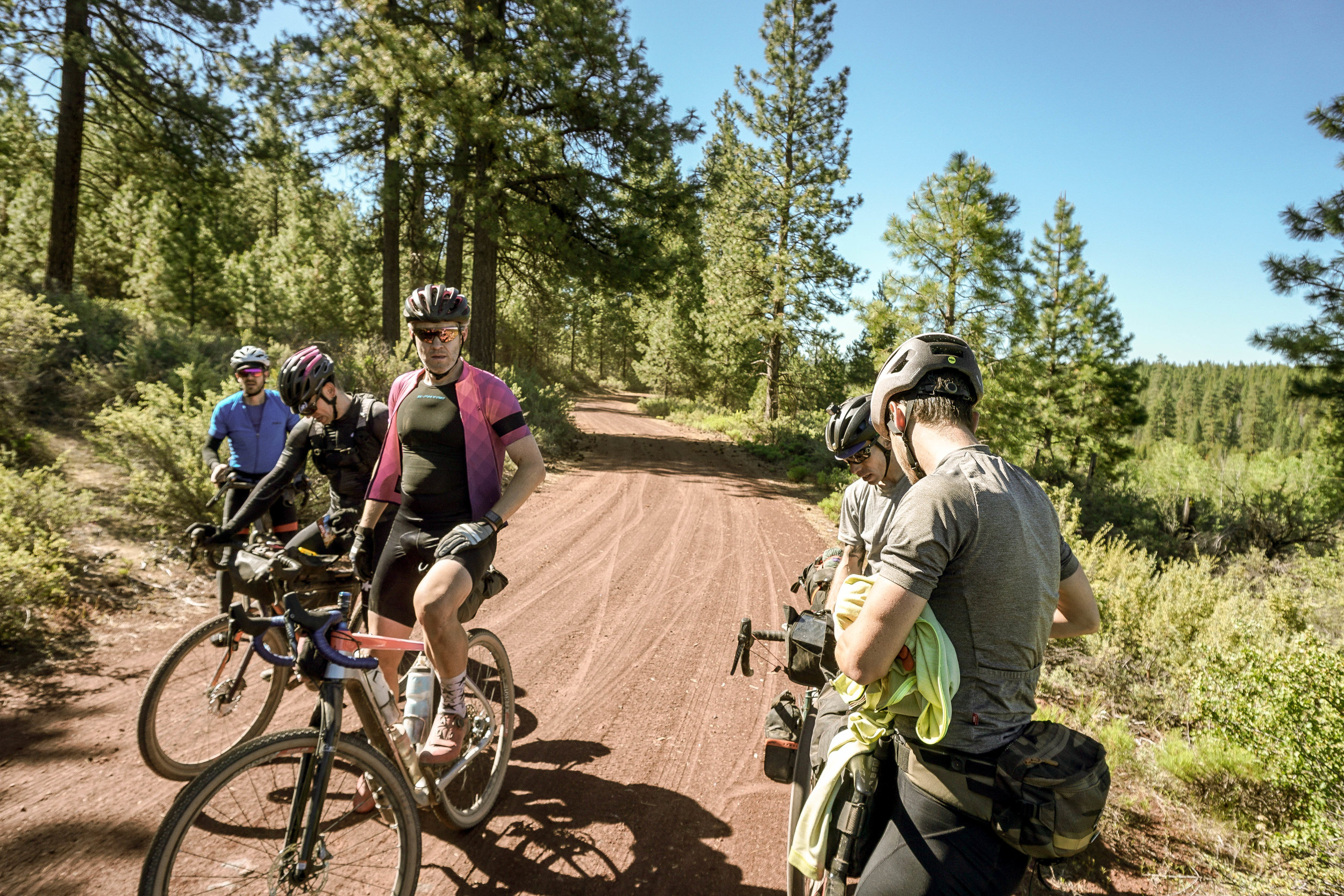


The old east entrance of Crater Lake National Park isn’t really used any longer, but is still accessible via foot or bike. The trail goes up Sand Canyon toward the Pinnacles, which were much better in-person than expected! This section of the park had yet to be opened to the public as the road from Crater Lake still had quite a bit of downed trees and snow. This was slow going, but we managed to climb the dirt Grayback road to Crater Lake without spirits dampening. The deep blue of the lake was worth the effort, as were the snacks at the Rim Village Cafe. It was a shock to the system to suddenly emerge in a huge crowd of tourists, but the views and terrain were worth sharing the experience with traffic. After lunch, we flew down from the pass towards the north park entrance.
Part 2: Diamond Lake, Umpqua National Forest, Middle Fork Willamette River, Oakridge
Diamond Lake has a pizza spot which served as another quick stop to refill bottles and eat some ice cream. Rule 1 of bike touring: If there is pizza. You stop. Our group became somewhat splintered at this point with a yo-yo effect taking shape, creating a string of riders stretching out for the next 300 miles. We crossed the Umpqua River Trail reluctantly. Such a beautiful stretch of singletrack, but unfortunately not on the menu for today. It is worth a side trip though for those who have more time. The river flows to the west, and we were headed north, so a quick look was all we could afford.
The climb up the flank of Sawtooth mountain was quite challenging, but luckily there are a number of plateaus in which gradients relent. No slowing down though or the mosquitoes would swarm.


Looking behind us, the road stretched to the horizon with Mt. Theilsen as the backdrop. Finally cresting the top at the border of Umpqua NF and Willamette NF, we knew the next 30 miles were almost entirely downhill. With a hard cut off of 9PM for the Oakridge Brewers Union Local closing time, we dropped elevation like bats out of hell. A side option on the descent is to converge with the Middle Fork Trail, and take single track down into Oakridge. This is one of the overlap moments with the Timber Trail. For us, the smooth pavement of NF21 was a better choice this day, as we were hungry, and ready for a rest. The miles flew by, and when the descent flattened a bit, a pace line took shape and Oakridge arrived in a blur. Rolling into town at 7:30, the locals in front of the pub had a laugh at this dusty band of road warrior in spandex. Disbelief at where we had just come from was appropriate. Oakridge is the Mountain Bike Capital of Oregon, so while no stranger to piles of bikes at the pub, they’re generally of the flat bar variety rather than our semi-loaded Allroad bikes. Being such a bike friendly town, our stay at the Oakridge Lodge was fantastic. A bike room, work stand, and bunk rooms provide the perfect haven for a ride like ours. Sleep and a homemade breakfast later, we were ready for a long day ahead.


Part 3: Mckenzie River Trail, Willamette National Forest, Detroit
Departing Oakridge, things once again turned wild, pitching straight into a mountainous 12-mile climb. Painful but beautiful. Tiny roads, paved respites, and smooth double track. Cresting the pass, the flowing gravel descent was super fast, perfectly banked corners inspiring confidence. We flew down the 15 miles to the McKenzie River. As we dropped in elevation, temps began to soar. By the bottom we were overheating in the full force of the summer sun. Taking a secondary gravel connection back towards Mckenzie Bridge kept us off the busy roads, arriving in town ready for lunch, just 58 miles into the day. Mckenzie Bridge has a very well-stocked store and grill with plenty of vegan-friendly choices. Given that this was the main stop of the day, we all sat down to lunch. However feeling pressed for time, a handful of us headed out early, splintering the group. At the edge of town, we dropped into the lush and magnificent McKenzie River Trail.


For many, including a large section of singletrack in a 220 mile day may seem questionable, but to me it is a chance to relax and be present. Now totally in the moment, we picked our lines through the loam, roots and piney duff with ease. I felt uplifted in spite of the gut-punch of some of the river climbs. Most river trails in Oregon are beautiful and McKenzie is no exception. Avoiding the rockier segments, we kept to the west side of Clear Lake with it’s preternaturally turquoise water, merging with the OTT a second time along the Santiam Wagon Road. Crossing the highway again we are immediately immersed back into the wild. This is a fascinating region of Oregon. No big name landmarks or parks, yet still some of the most spectacular areas for adventure cycling. It contains some of the most surprisingly smooth single-lane pavement in Oregon as well as some of the best gravel roads. Though our way is technically shared with OHV, it is quiet and car-free. Turning up Scar Mountain Road, we portage a creek crossing and head down NF10 towards Detroit. A grin-inducing, scenic wonderland of a descent ensued, the looming visage of Mt. Jefferson to our right forcing a few rubbernecking moments. Eventually transitioning to smooth pavement, the miles flew by and our group somehow managed to reconvene in Detroit. Some of the riders who stayed behind at lunch ended up using a shortcut to arrive at the same time. After a brief food stop, it was time to turn on the lights and head into the night.
Part 4: rhododendron ridge, Clackamas River, Mt. Hood National Forest, Portland
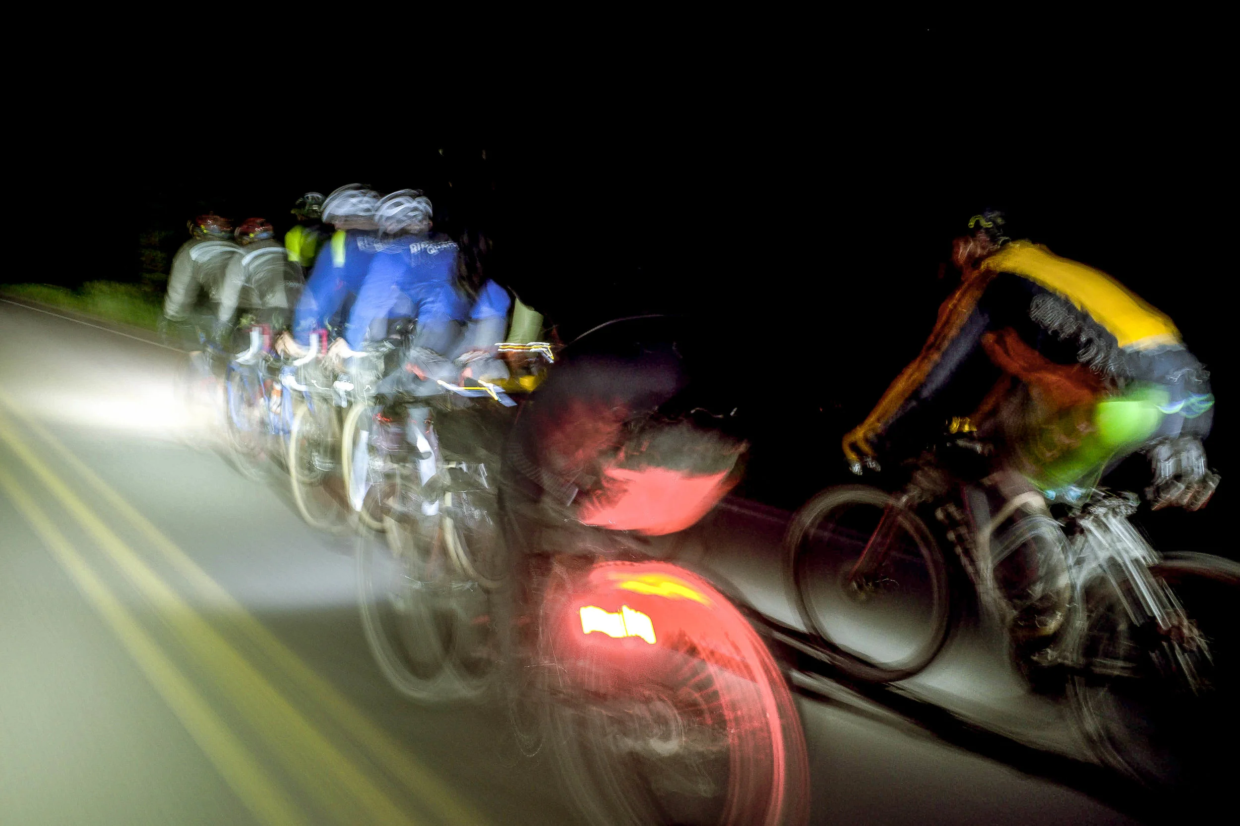
There are a few ways to do this section, and the OCVA routing presented assumes at least 3 days for the entire routing. In our case, we had to do some further streamlining to get us back to Portland before morning. The official route opts for a more scenic traversal, though in our case, we rode at night and thus the world was limited to the beams of our headlights and the stars above. After climbing the pass we began a very long paved descent along the Clackamas River towards Portland. An official Oregon Scenic bikeway, NF 46 is absolutely lovely, a worthy destination in its own right. At night, it felt exhilarating and fast after all the miles logged on gravel and singletrack earlier in the day. We were alone in the darkness, 8 lights flying. We kept the remainder of our group together for this last segment, arriving in Portland at 4AM, exhausted but thrilled to have pulled it off: riding the entire vertical length of Oregon within the very ambitious timeframe of two days!
* Ryan Francesconi
** Rider group & photos: Michael Khamsot, Devin Bailly, Kier James, Ben Im, Josh Hulst, Dustin Henderson, Tom Jeanne, Dimitrios Papadimitriou, Stephan Niquet, Jan Heine, David Wilcox, Ryan Francesconi, Tollman Owens, Tony Thayer, Ron Kizziar


412.4 MILES
28,572 FEET
ROUTE FORMAT: point to point, 3-4 days
SURFACE: 50% gravel, 44% pavement, 6% singletrack
TIRES: 40c+ with emphasis on the ‘+’
BIKE: GRAVEL touring/adventure
FULL RIDE WITH GPS ROUTE
Terms of Use: As with each adventure route guide published on OMTM.CC, should you choose to cycle this route, do so at your own risk. Prior to setting out check current local weather, conditions, and land/road closures. While riding, obey all public and private land use restrictions and rules, carry proper safety and navigational equipment, and of course, follow the #leavenotrace guidelines. The information found herein is simply a planning resource to be used as a point of inspiration in conjunction with your own due-diligence. In spite of the fact that this route, associated GPS track (GPX and maps), and all route guidelines were prepared under diligent research by the specified contributor and/or contributors, the accuracy of such and judgement of the author is not guaranteed. OMTM.CC, its partners, associates, and contributors are in no way liable for personal injury, damage to personal property, or any other such situation that might happen to individual riders cycling or following this route.