

The Metolius basin is a curious region of distilled Cascadia. Quintessentially Oregonian. Sedimented by volcanic and glacial debris over the millenia, lined to the west and south by seven geologically youthful peaks, all less than a million years old. The basin is hemmed in to the east by a fault scarp rising 2000 feet above the valley floor and bisected by the crystalline turquoise waters of a Wild & Scenic River bubbling up from the base of an extinct andesite stratovolcano.

Set against one of Oregon’s most dramatic volcanic skylines, the Metolius basin is understatement at its finest. This spring-fed tributary of the Deschutes bubbling up from beneath Black Butte has the feel of a lazy river without anywhere to be and all the time in the world to get there. Evoking a bygone era, the Metolius’ recreational hub, Camp Sherman is like stepping into the pages of a vintage issue of Field & Stream magazine.
Because of its unusual geology, ecology, fish and wildlife, the river is protected by the National Wild and Scenic River Act of 1988 and Oregon’s Metolius Protection Act. In 2009, the legislature designated the 448 square miles of the Metolius River basin as an Area of Statewide Concern, effectively preserving it in time by prohibiting development of new residences, golf courses or resorts within the watershed, which explains the region’s quiet, sparsely-developed mid-century angler’s sensibility.
The Metolius is named for the Sahaptin word meaning white fish, a reference to light-colored Chinook salmon which historically thrived in the river’s cold and stable waters. The river is a sacred place for the Wasco, Warm Springs, and Northern Paiute of the Confederated Tribes of the Warm Springs, who have hunted, gathered, and fished the river for thousands of years. Legends tell of Black Butte and her husband Green Ridge who embarked on a journey carrying roots, berries and deer for sustenance. In the course of their travels, Black Butte sat down to rest under the hot sun and began to sweat. While Black Butte rested, her husband, Green Ridge, began to pout. Together their sweat and tears intermingled to form streams, whose combined waters gave shape and life to the Metolius.


Head of the Metolius
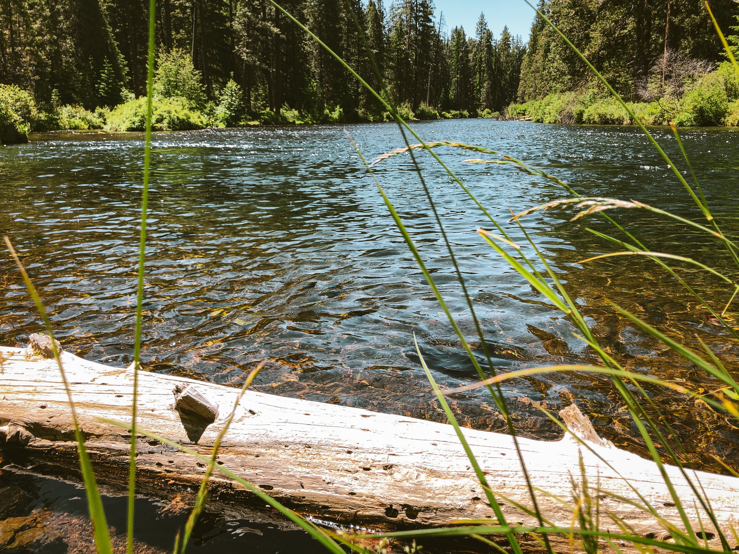
The cold, clear waters of the Metolius rise from a series of springs at the base of Black Butte, the distinctive 6,436-foot tall volcanic cinder cone that dominates the south end of the valley. Emerging with a year-round temperature of exactly 48 degrees, the waters of the Metolius do not come directly from surface water or snowmelt but from a number of smaller springs deep in the Cascade high country. These waters flow underground through layers of porous volcanic rock, emerging west of the river as a series of remarkably clear spring creeks.

green ridge
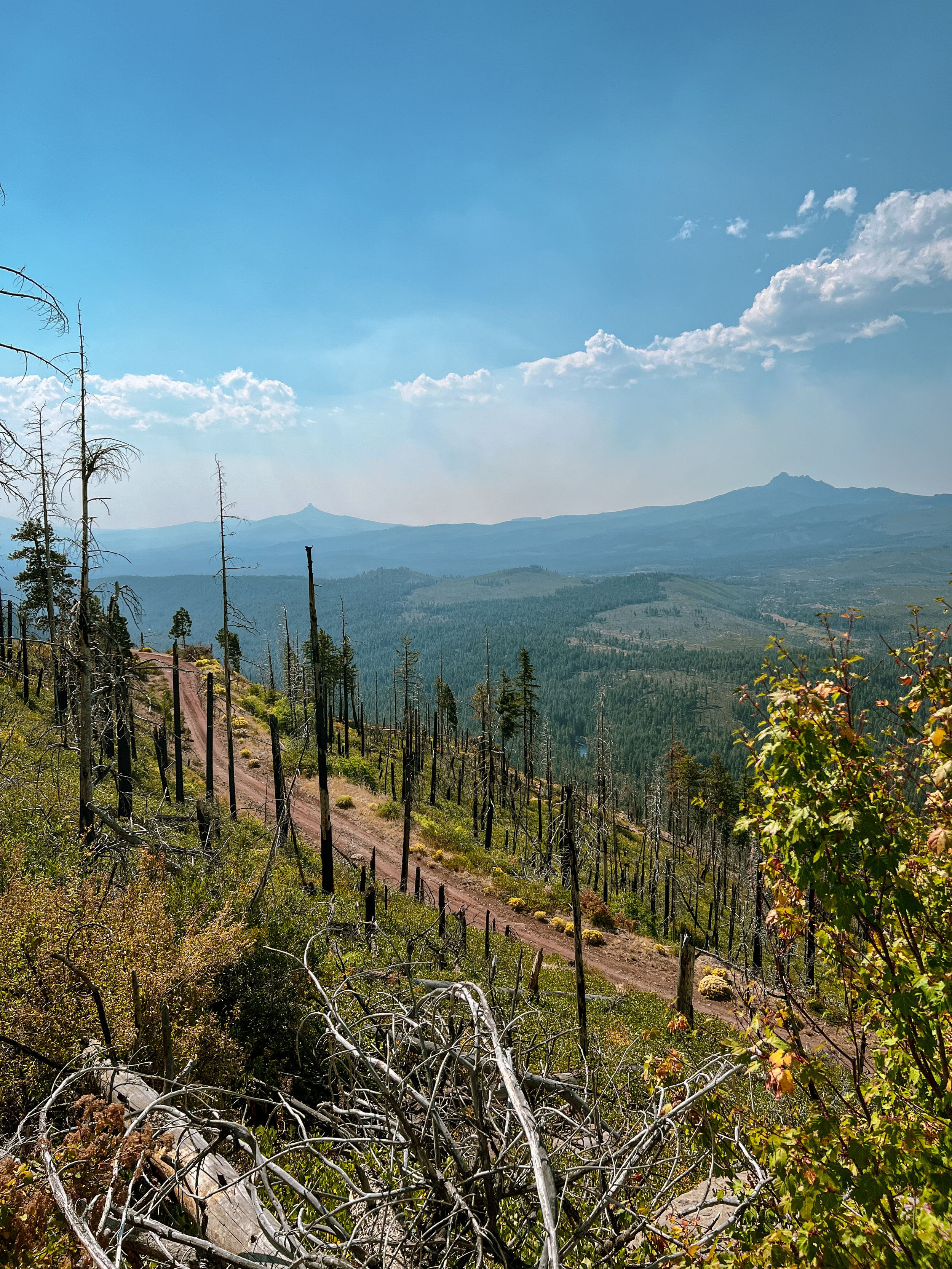
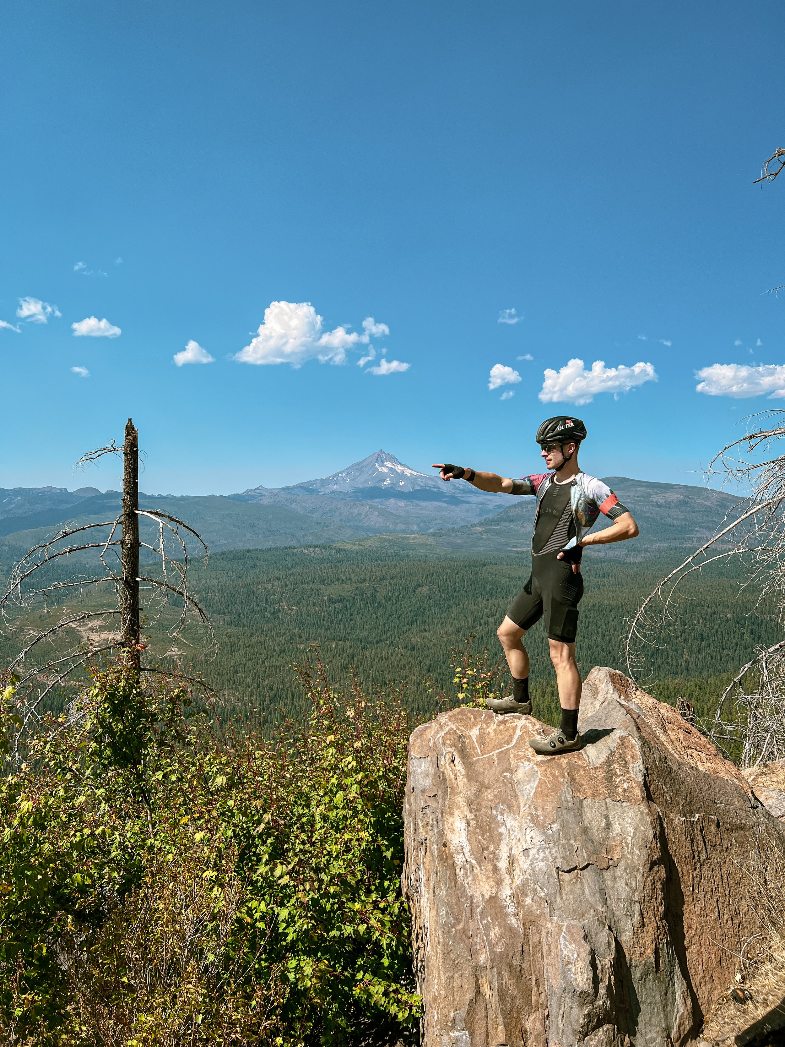
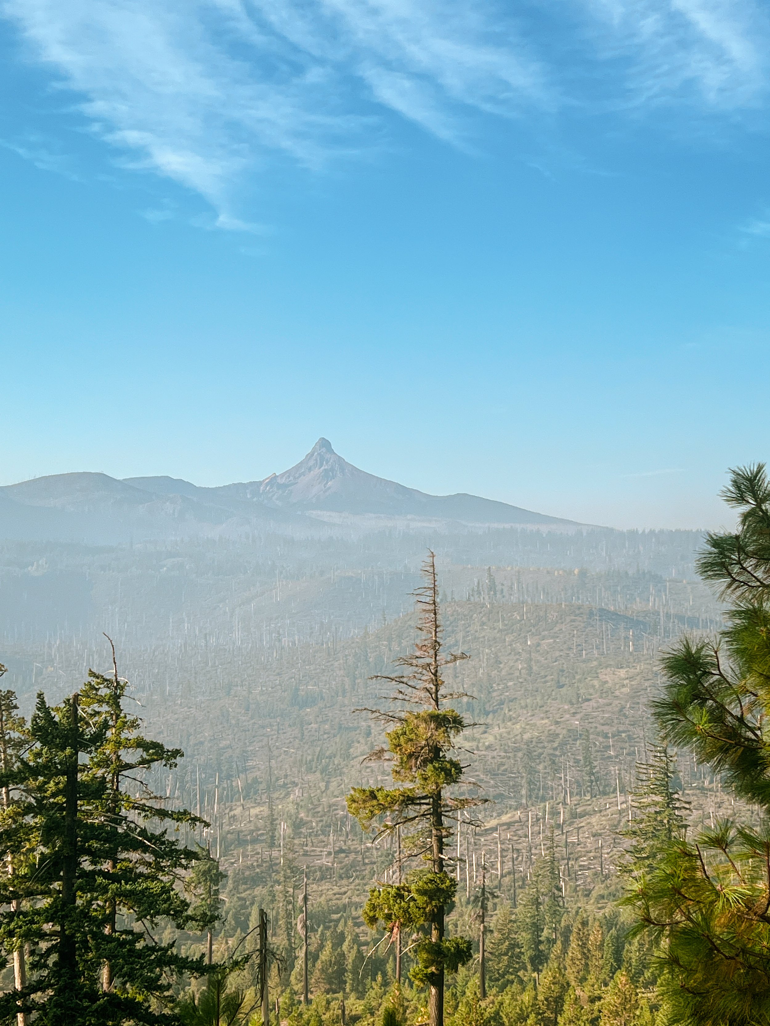
Green Ridge is the formidable 4660-foot volcanic fault scarp comprising the last 1/3 of the route. It is a bear of a climb – hot, exposed, chunky and relentless. It is also the centerpiece of the route with jaw-dropping sightlines of the entire valley including Black Butte, the Three Sisters, Mt. Washington, Three-Fingered Jack and Seekseekqua (Mt. Jefferson). The Green River Trail picks up just south of the fire lookout access road and features an intertwined mix of sandy singletrack and doubletrack Jeep trail. The trail begins trending downward around mile 48 through vibrant wildflower meadows and intermittent burns. The tread is a mix of dusty sand and piney duff intercut with technical rocky basalt. Be sure to top off your water bottles at the river crossing prior climbing Green Ridge as it will be your last opportunity for available water within the route.


Camp Sherman
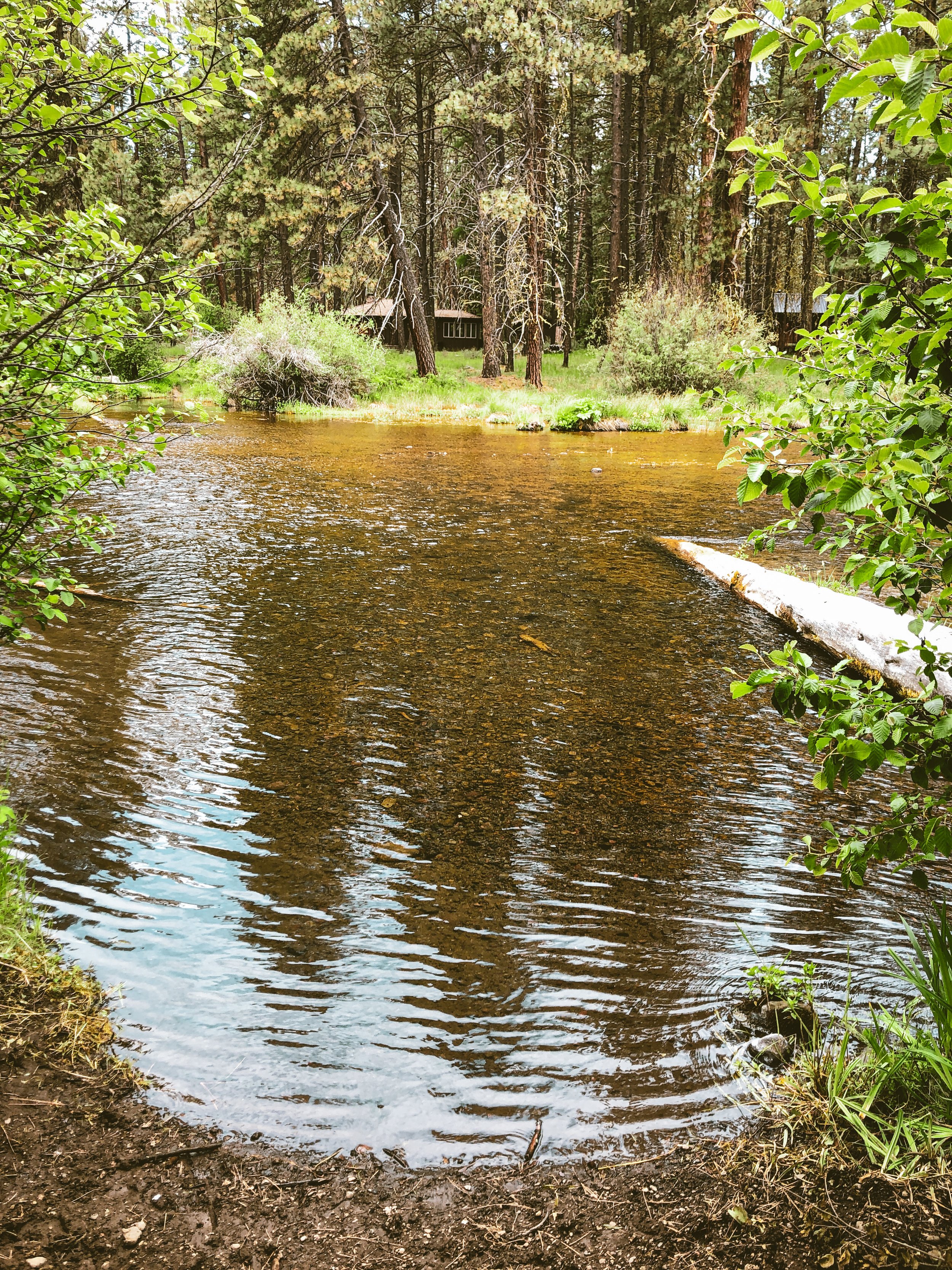
The heart of the Metolius basin is Camp Sherman, an unincorporated community and loose conglomeration of private cabins, low-key rental lodges, rustic campgrounds and fly fishing spots. There is one general store – the timeworn hub around which most of the valley’s activity revolves. It is exactly what you’d expect given the surroundings – one part convenience/deli/camp store, one part beer and wine purveyor and the rest a meticulous angler’s supply.


Suttle Lodge & Boathouse
Looking for a soft landing with all the amenities? The Suttle Lodge & Boathouse is a rustic-chic National Forest-style lodge hotel and cabin complex nestled on the eastern shore of Suttle Lake. Playing to a Portland crowd, Suttle Lodge is a comfortable slice of glampy Oregonia with mixology-grade cocktails and artisanal pub grub – the Poler Stuff to Camp Sherman’s Mark Trail vibe. Quite busy in the high season, expect daytrippers, kids and dogs in various stages of coming and going.


Highlights
The Lake Creek Trail is a four mile rambling beeline from the heart of Camp Sherman to Suttle Lake via sandy, loose cinder-track. Sometimes singletrack, sometimes double, it doesn’t get any more blissfully Camp Sherman than this.
The climb to Round Lake is five miles of gentle gradients, cinder road and rocky Jeep trail to the fringes of the Mt. Jefferson Wilderness to bask in the rugged visage of Three-Fingered Jack. Come early if you plan to camp at Round Lake as it is a hot spot among the overland and dispersed camping set.
The circumnavigation of Abbott Butte takes the form of a long, wonderfully gradual climb and descent sequence. Expect roads of chunky red cinder through snowbrush and manzanita shrubland beneath the immense looming shadow of Seekseekqua.
The Head of the Metolius. There is a parking lot, a forest service placard and a paved trail leading to a cupola which overlooks the wetland springs comprising the actual Metolius headwaters. Nothing terribly dramatic to look at but worth a quick visit as it is right on the route.
The climb to Green Ridge is not to be taken lightly but it is worth the effort. The gradients are gentle enough, but it is fully exposed and can be very hot late in the day. Be sure to fill up at the river before starting up NF1490 as there is no available water for the next 20 miles. The views all the way up are worth every pedal stroke.
The Green Ridge fire lookout is arguably the best view of the entire route. It is highly recommended to do the optional out-and-back. Be aware that the lookout is available for private rental so be respectful and don’t disturb folks who may be staying inside.
The Green Ridge Trail is 8.3 miles of incredibly blissed-out backcountry singletrack running along the edge of Green Ridge from the fire lookout access road to Allingham Cutoff road. Expect potent wildflower meadows, ponderosa pine and a rolling mix of single and doubletrack. Be sure to note the embedded POI in the route as the trail interleaves with doubletrack Jeep trail in places. At mile 47.5, the trail diverges from the primitive road and can be a bit tricky to follow if you’re not paying attention.
seasonality
Optimal early summer through mid fall. Usually accessible June through early October.
ORIENTATION
Though officially routed clockwise, it can be also be run in reverse for a slightly different flavor. Each direction has its pros and cons so choose your adventure wisely. Orientation will not change availability of water (spots marked within route). Primary considerations will be the three significant climbs – Round Lake, Abbot Butte and Green Ridge. Cool morning light vs. full exposure in the late afternoon sun. Pick your poison.


METOLIUS HEADWATERS
56.3 MILES
5702 FEET
ROUTE FORMAT: LOOP
SURFACE: 80% UNPAVED, 6% PAVED, 14% SINGLETRACK
TIRES: MINIMUM OF 45C. 2” RECOMMENDED. TUBELESS HIGHLY RECOMMENDED
BIKE: GRAVEL/ADVENTURE/HARDTAIL
WATER FILTER: required
SERVICES: camp sherman general store, suttle lodge
FULL RIDE WITH GPS ROUTE + GPX FILE

Terms of Use: As with each adventure route guide published on OMTM.CC, should you choose to cycle this route, you do so at your own risk.
1. The www.omtm.cc site and @omtm.cc Instagram account (collectively, the “Site”) are owned and operated by Our Mother the Mountain LLC (“OMTM”). The Site is primarily a creative project presented by OMTM and other contributors, but it is increasingly being used as a resource for other cyclists seeking challenging and compelling cycling routes. As such, we want to be clear about what the Site is and is not.
2. It is a creative project and may be used as (a) one resource (of many) for potential routes and (b) a source of inspiration for cyclists.
3. It is not designed to be a replacement for your own diligence and judgment. You should engage in significant additional diligence, and use your judgment regarding the route and your abilities, before embarking on any route described on the Site. You are solely responsible for obeying all public and private land-use restrictions and rules, carrying proper safety and navigational equipment, and following the #leavenotrace guidelines.
4. The information on the Site is for general information purposes only. While we made reasonable efforts to ensure the information was up-to-date and correct when it was posted, the information may be incorrect, incomplete, or outdated. We make no representations or warranties about the completeness, timeliness, accuracy, reliability, or quality of the information. Nor are we able to promise anything regarding weather, route conditions, or route availability. Everything is provided on an “AS IS” and “AS AVAILABLE” basis, and any reliance you place on information available through the Site is at your own risk.
5. Without limiting the foregoing, OMTM is not responsible for GPS content provided by third-party contributors or third-party sites or platforms (such as Discord, Google Groups, and Strava Club) that may be linked or referenced on the Site: we do not own or operate such sites or platforms and are therefore unable to vouch for any content on those sites or platforms.
6. Cycling is an inherently dangerous activity, and we are unable to control the actions of third parties (including without limitation other cyclists or users of the routes). As such, the Site is not designed (or able) to reduce or eliminate your risk of injury, death, or property damage. We assume no responsibility for injury, death, or property damage.
7. You and your heirs, personal representatives, and assigns, agree to indemnify, defend, and hold OMTM, its owner(s), and all OMTM contributors harmless from and against any claims arising out of or related to your use of the Site.