

STEADY ELEVATION GAIN, SWEEPING S-CURVES AND LUSH alder FORESTS TRANSITION TO STARK, ROCKY, RAVAGED ALPINE LANDSCAPES OF TRULY EPIC SCALE AS NF-99 SNAKES ALONG THE BARREN EASTSIDE RIDGES OF THE ST. HELENS BLAST ZONE.
The quiet east side of St. Helens offers a challenging but rewarding out-and-back route stretching from the Pine Creek Information Center to the Windy Ridge Observatory on the mountain's eastern shoulder.
The route begins at the Forest Service's Pine Creek Information Center at the east end of Swift Reservoir along NF-90 near the intersection w/ NF-25. Leaving the Information Center, we head north on NF-25 rolling through dense mossy greenery and gurgling creeks. This section is fairly flat but begins to rise once past the NF-25 winter gates and really kicks into high gear north of Smith Creek, climbing over 2000 ft. in the first ten miles.


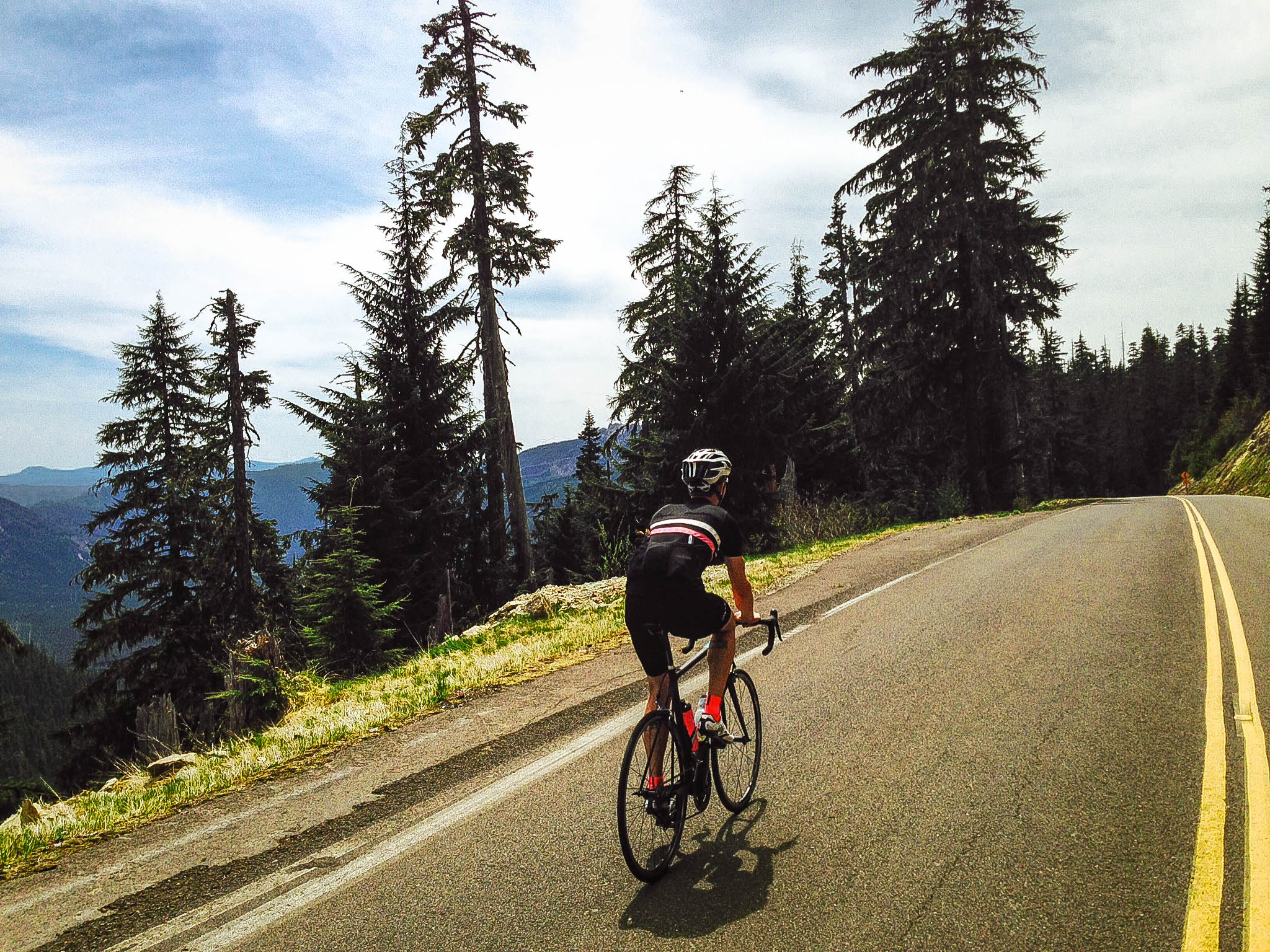
With the elevation gain over the first twenty miles, the magnitude of the landscape begins to reveal itself, beginning with occasional sightlines to the valley floor, increasing in perspective and scale until breaking out of the trees around mile 21 at Elk Pass with our first real views of St. Helens. The next 4 miles descend in a sweeping array of perfectly proportioned S-curves right down to the intersection with NF-99. While the urge will be to bomb this descent, ease up a bit as the northbound lane has quite a few rough spots, unexpected dips and bits of broken asphalt.
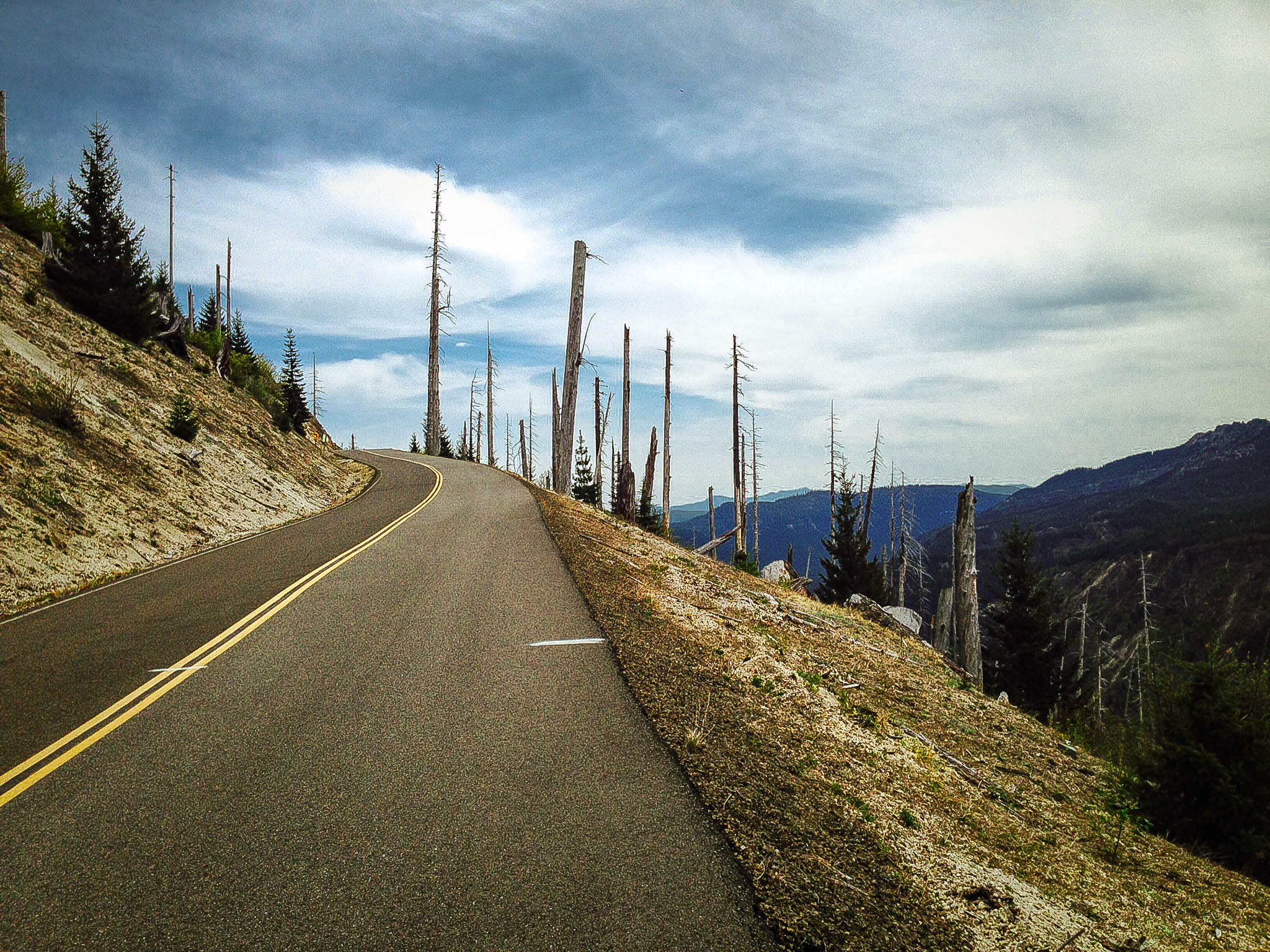
NF-99 heads west and begins climbing into high alpine valleys and along increasingly arid, rocky ridgelines. At mile 32, NF-99 emerges from the treeline altogether into the desolate alien landscape of the St. Helens blast zone. It's hard to comprehend the magnitude of the devastation. Entire mountainsides scorched to bedrock, the bleached bones of entire forests are laid out like matchsticks with a grotesque symmetry. NF-99 snakes like an asphalt ribbon, rising and dipping along the contours of hillsides, doubling back on itself, visible for several miles as it stretches westward along the ridge.

The pavement condition on upper NF-99 has several rough patches, the asphalt torn, stretched and collapsed in spots as evidence that this is still very much an active volcano. There are frequently large rocks and debris in this section, so keep alert.


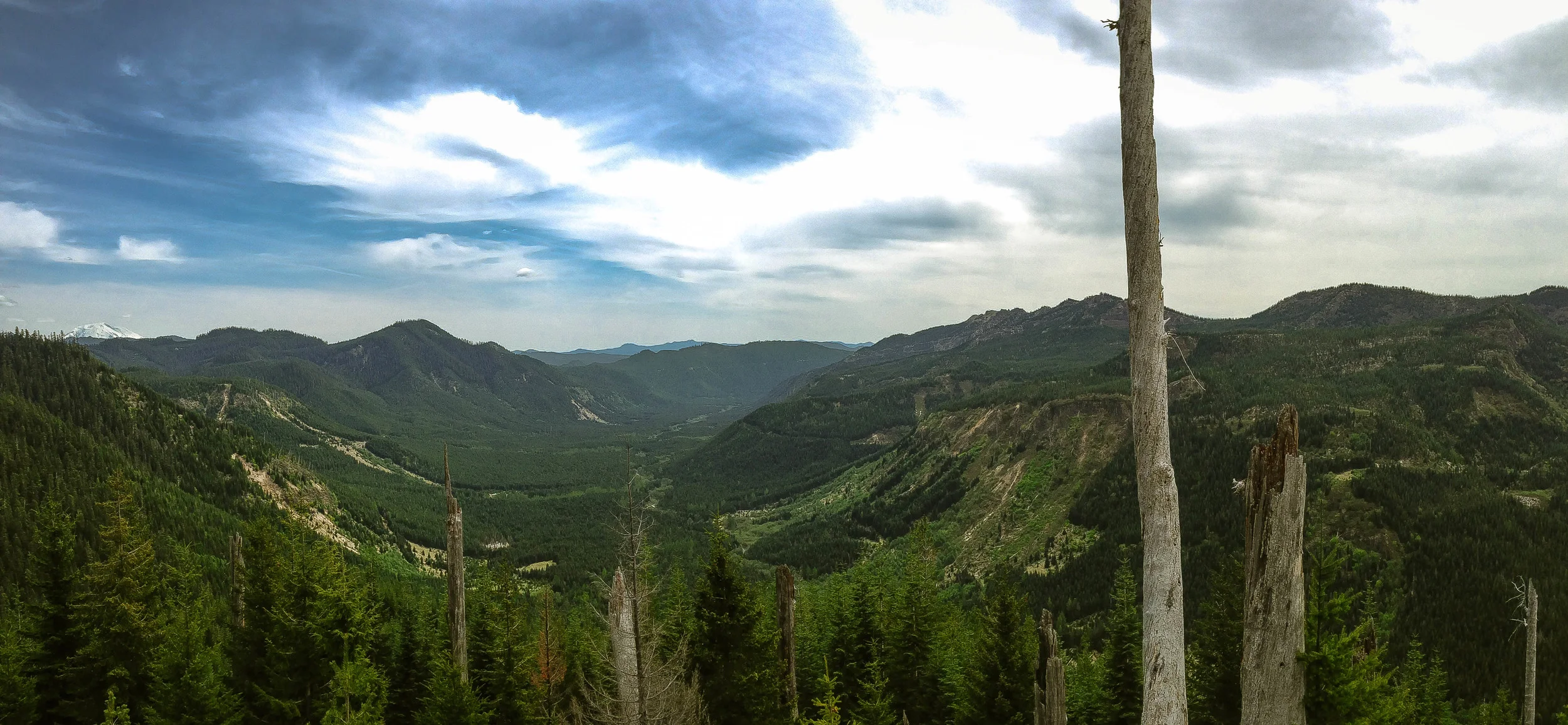
The turnaround point is Windy Ridge Observatory, just east of the St. Helens crater. This vantage point provides unbelievable views of Spirit Lake, the debris avalanche deposits and the entire pumice plain, stretching for miles to the northwest. From this point, the route retraces itself back through the rolling blast zone, where many of the 'slight dips' on the way in feel a bit more punchy and pitched on the way out. A near-constant westerly tailwind is a minor consolation. As soon as the pavement sinks back below the treeline it becomes a ripping descent with tight well-spaced curves and great angles all the way back down to NF-25. From here things settle in for the gradual climb back up to Elk Pass. The payoff comes in the form of an invigorating 20 mile, 3000 ft rolling descent from Elk Pass back down to the Pine Creek Information Center.
A word of caution regarding water and nutrition: There are zero services along the way, so plan accordingly. Two large water bottles are the minimum recommendation. In warmer weather, it would highly adivised to pack a SteriPen or lightweight backpacking filter as there are several small creeks/waterfalls higher up on NF-99 giving ample opportunity to top off. Another warm weather option (and convenient advantage of the out-and-back format) is to jersey a third bottle which can be stashed discreetly for the return journey at the intersection of NF-25/99. With a gradual rolling climb of over 6000 feet up to Windy Ridge, and much of the upper sections highly exposed, you'll want to stock plenty of calories and hydration.
Have fun, stay safe and enjoy.


83 MILES
9098 FEET
ROUTE FORMAT: OUT-AND-BACK
SURFACE: 100% PAVED
TIRES: 23C-25C
BIKE: ROAD
full ride with gps route + gpx file
Terms of Use: As with each adventure route guide published on OMTM.CC, should you choose to cycle this route, do so at your own risk. Prior to setting out check current local weather, conditions, and land/road closures. While riding, obey all public and private land use restrictions and rules, carry proper safety and navigational equipment, and of course, follow the #leavenotrace guidelines. The information found herein is simply a planning resource to be used as a point of inspiration in conjunction with your own due-diligence. In spite of the fact that this route, associated GPS track (GPX and maps), and all route guidelines were prepared under diligent research by the specified contributor and/or contributors, the accuracy of such and judgement of the author is not guaranteed. OMTM.CC, its partners, associates, and contributors are in no way liable for personal injury, damage to personal property, or any other such situation that might happen to individual riders cycling or following this route.