

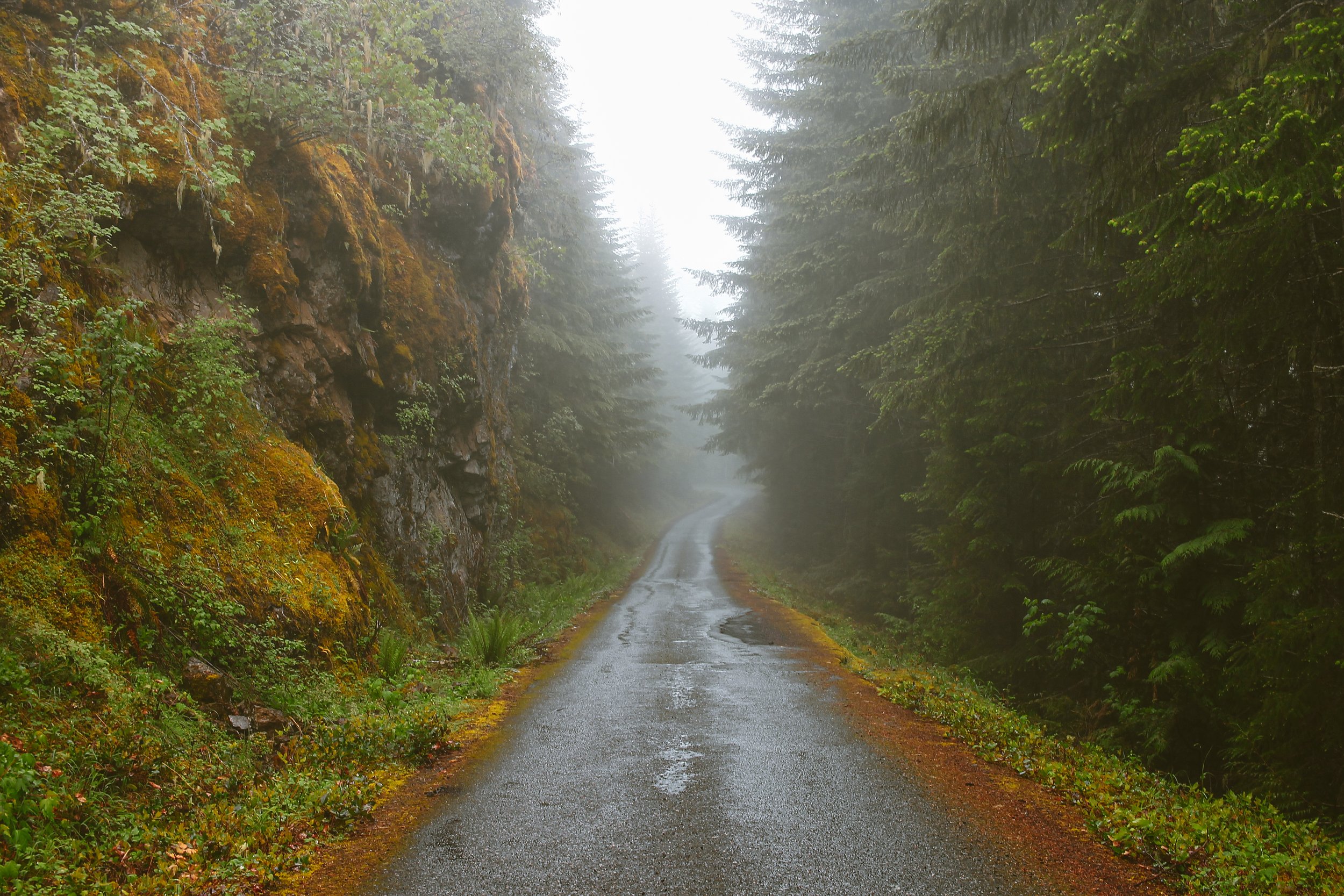
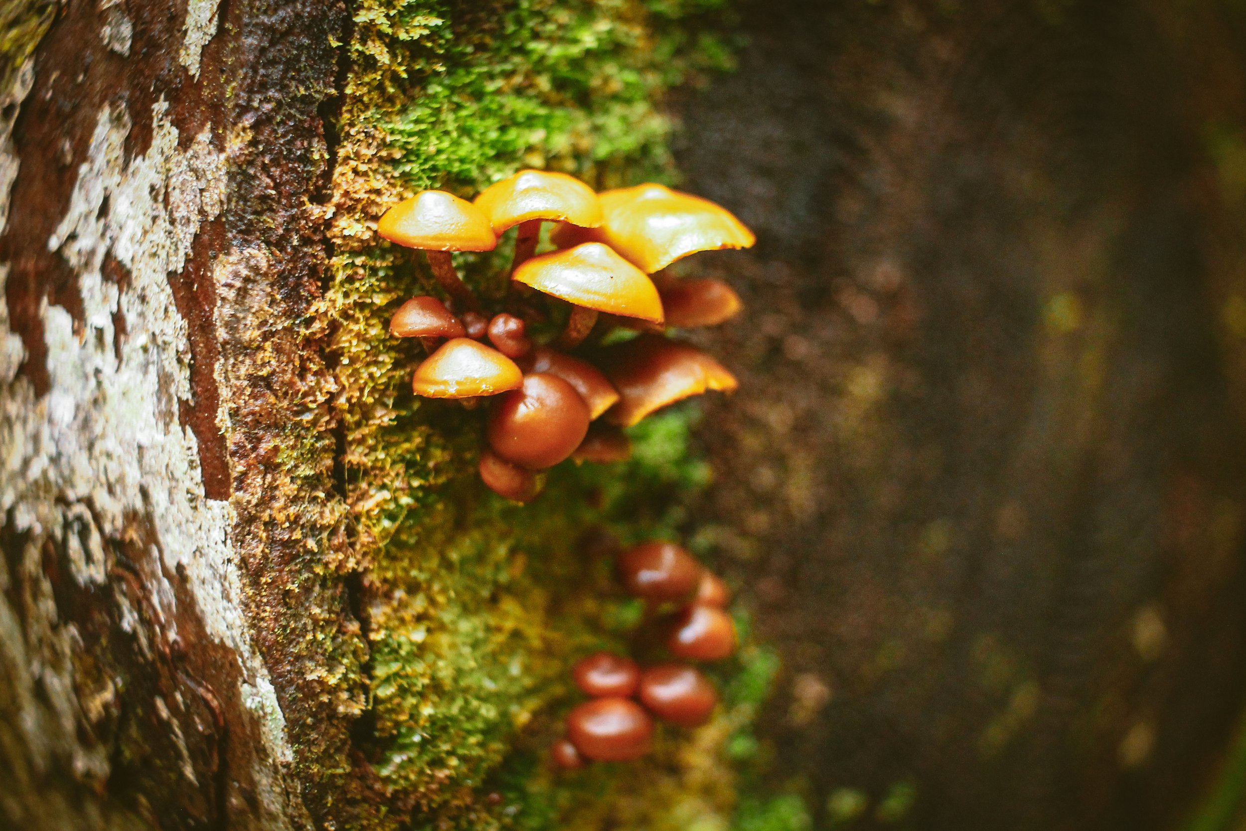
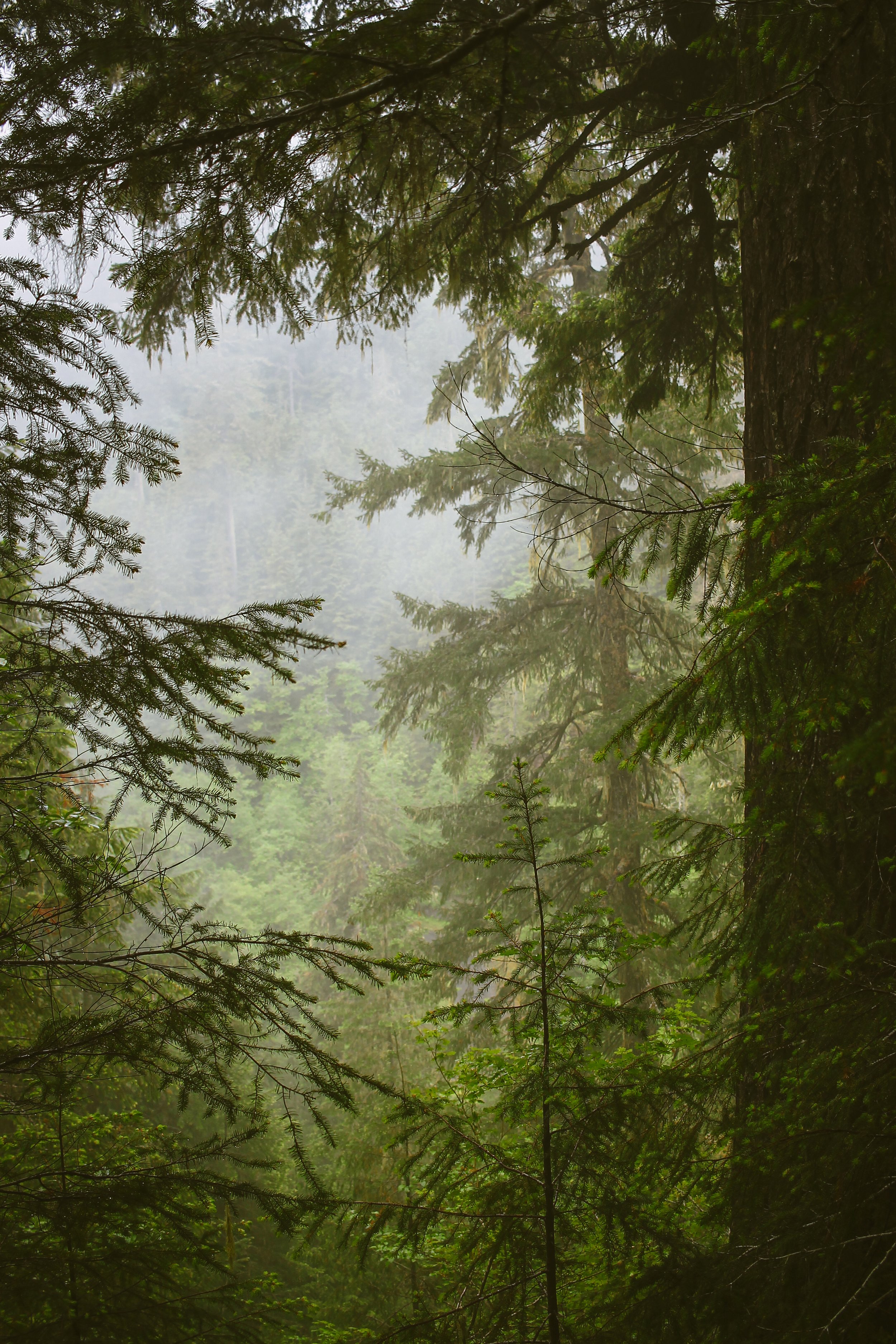
This lush Olympic adventure explores the primeval cloud forests and twilit river valleys of the Peninsula’s curious east side. Characterized by untold variations on the idea of green, expect ancient stands of old growth – Douglas fir, Western hemlock, red cedar, Sitka spruce, and abundantly moody forest roads with a moderately haunted sensibility. The centerpiece of it all is a sublime 6-mile stretch of downright jurassic backcountry singletrack through the dank, brooding heart of the Big Quilcene watershed.


Mt. Zion Edition
53.6 miles | 6128 ft | 60% maintained gravel, 30% paved, 10% singletrack | 42c min – 2” plus | water filter highly recommended
This spirited 53.6-mile adventure explores some of the many quiet sides of the Olympics. The route climbs west out of Quilcene, gently up through forests of Sitka spruce, Douglas fir and western red-cedar before dropping into the Big Quilcene watershed. The route picks up the Lower Big Quilcene Trail at mile 6.5, descending along steep, densely-forested ravines, crossing the Big Quilcene river multiple times over rustic forest service bridges. The trail is a mix of moist, earthy needled duff and damp roots and rocks. Steepening northward, a fresh re-route navigates a sequence of switchbacks before angling up out of the valley to the Marmot Pass trailhead at mile 12.7. From here, the route climbs and descends quiet paved and gravel forest roads to Bon Jon Pass onward to the wild and wonderful two-track of 2849. Riders then descend Salmon Creek Road before turning southward toward Lord’s Lake reservoir for a smooth, rolling glide back into Quilcene.
Gold Creek edition
37.1 miles | 4826 ft | 50% maintained gravel, 30% paved, 20% singletrack | 42c min – 2” plus | water filter highly recommended
This well-rounded adventure shares a common front end with the Mt. Zion Edition – that means, the same trail section, the same wonderful forest road climb and descent sequences toward Bon Jon Pass, where the courses diverge. At mile 27.4, the Gold Creek Edition descends (you guessed it) Gold Creek Road toward Lord’s Lake and a series of gentle serpentine rollers back to Quilcene via Lord’s Lake Loop road.
From Seattle: BAINBRIDGE FERRY TO QUILCENE
58.3 miles | 4872 ft | 85% paved, 15% singletrack | 38c min – 45c recommended
This 58 mile ramble factors in a ferry ride from downtown Seattle. The line from the Bainbridge Ferry to Quilcene may be familiar to some. Highlights include 8 miles of Port Gamble singletrack, the town of Port Gamble itself, the Hood Canal bridge crossing, a roller-coasting stunner descent through Shine, a mid-ride dip at the Wm R Hicks Beach Park and the enchanted rolling backroads of the Toandos Peninsula. The Port Gamble trail section runs the gamut from smooth gravel forest roads to mildly technical cross-country singletrack. Our line sticks to drop bar friendly territory and predominantly dreamy-flowy, deeply-forested terrain with plenty of food and bevvie opportunities at the end of the tunnel in Port Gamble. Enjoy responsibly.


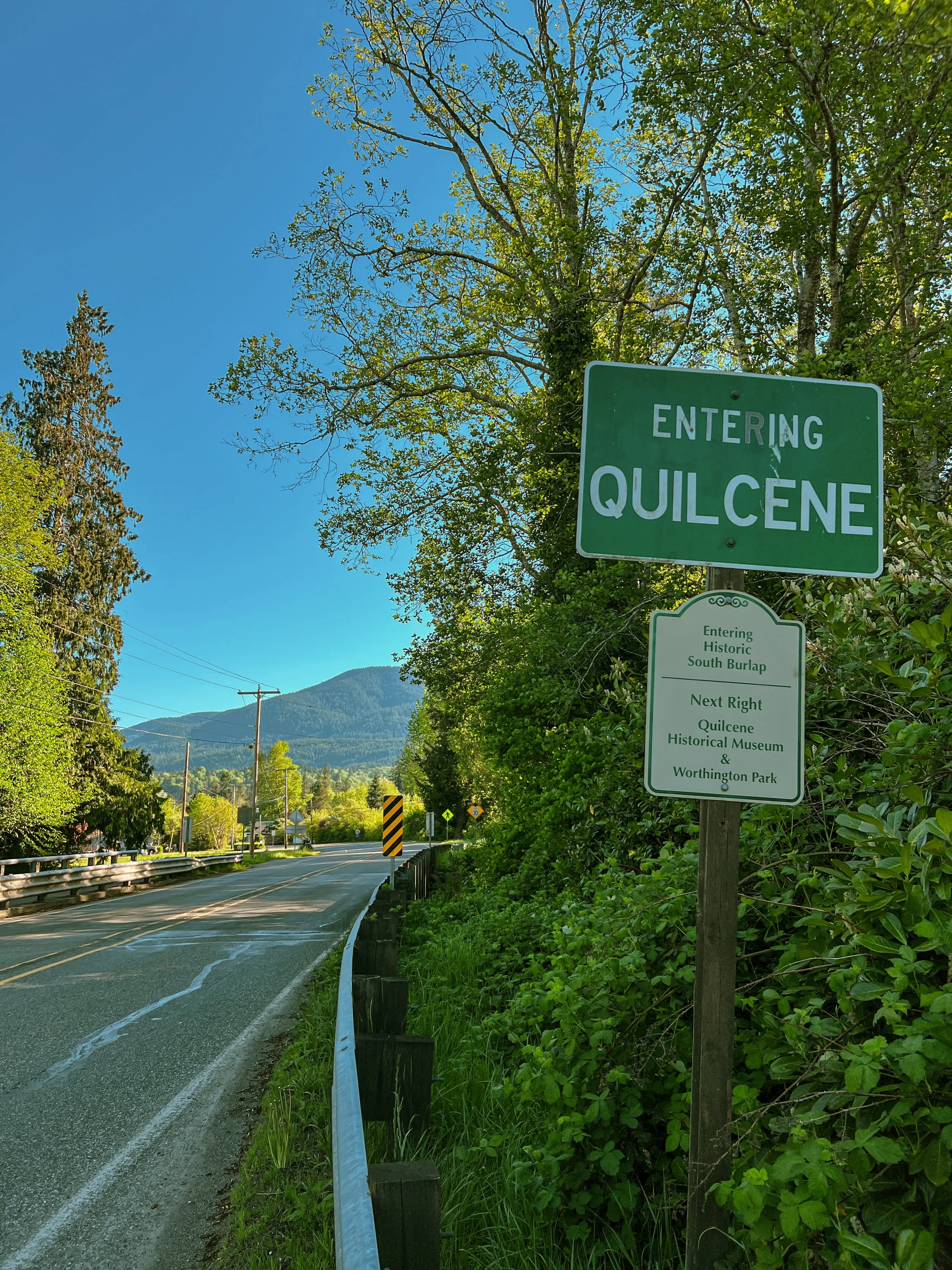
Quilcene
At first glance Quilcene seems like a glorified bend in the road; a scattering of houses, a school, a single restaurant and a pair of bedraggled grocery stores. But like a lot of places, Quilcene reveals itself if you put in the time. There is a distinct art-hippie-anarcho-farmer vibe just below the surface. It is hard to point to anything tangible but you can feel the undercurrent in and around the more conventional small town fare.
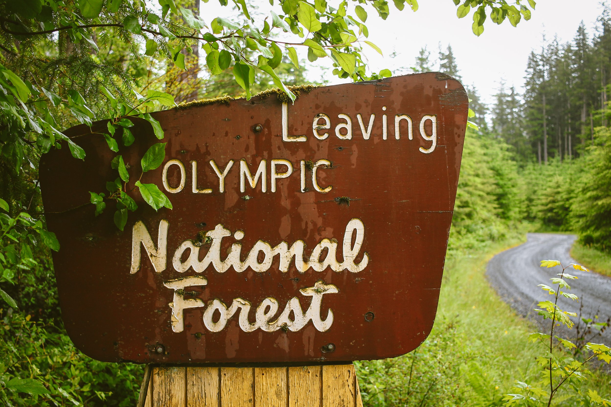
You will find a range of options from motel stays, multiple established campgrounds and dispersed camping within the National Forest boundary. We’ve lined up some resources below to assist in planning. Campgrounds are first-come/first-serve. The other, perhaps more open-ended option is dispersed camping in the nearby Olympic National Forest, which is 4.7 miles west of downtown.


Port Gamble
The ride out from Bainbridge skirts North Kitsap and the town of Port Gamble, taking a playful line through the Port Gamble trail system, also known as Stottlemeyer. This section uses a combination of smooth singletrack, forest access roads and a handful of mildly technical trails through lush, loamy, mosscovered forest. The system is fairly sprawling and complicated, so mind your directional cues at intersections.
Port Gamble is a historic milltown established in 1853 on the shores of the Hood Canal. Restored in 1996, Port Gamble’s handful of gabled clapboard houses and shops have a New England vibe and while it’s mostly a weekend tourist destination, I’ll call attention to both the General Store and House 11 Taproom & Bottle Shop. Both are exceedingly bike-friendly and an ideal scene change for a mid-ride sit-down. Highly recommended if you’re on a leisurely timeline.


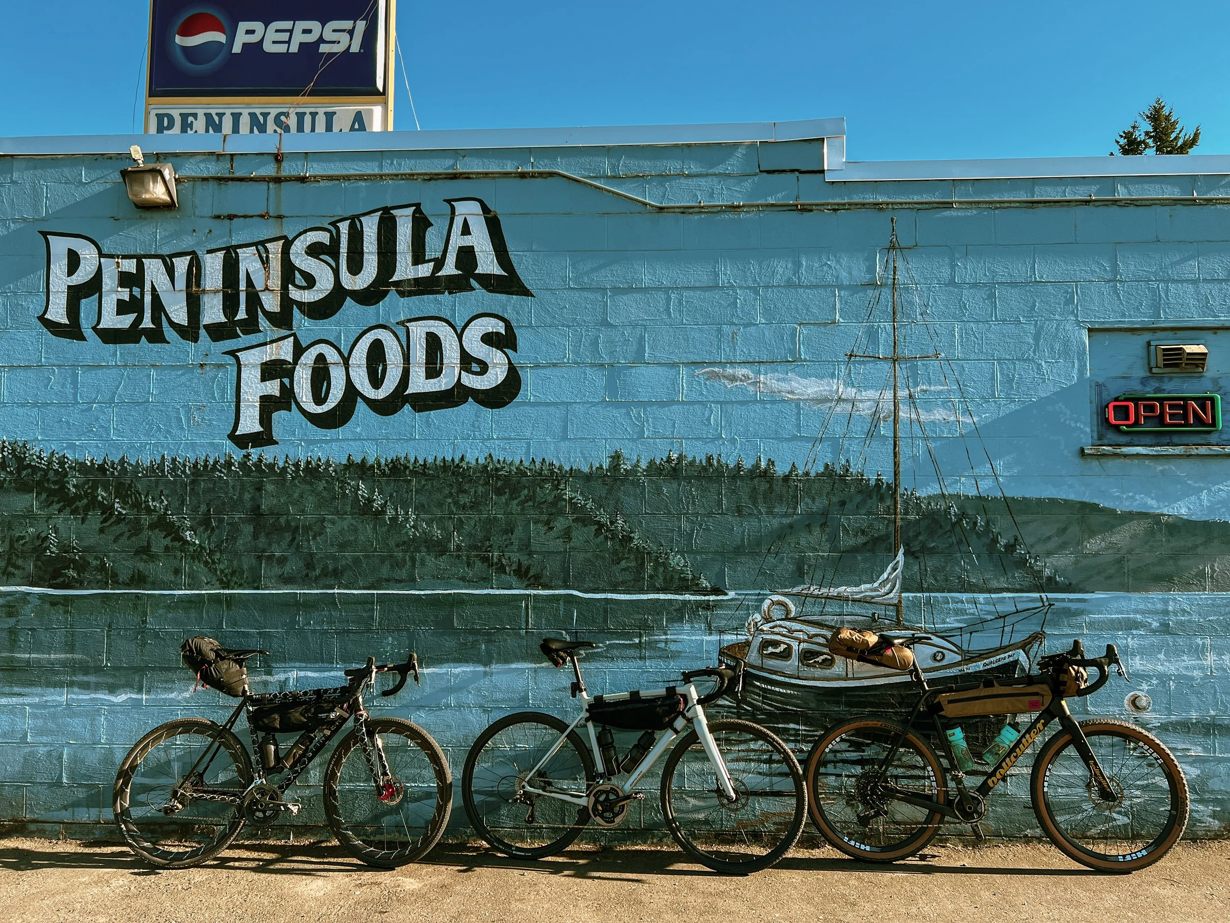
Quilcene Resupply & Food
As we mentioned there are options for grocery, food, bevvies and coffee in Quilcene. Peninsula Foods is well-stocked convenience-grocery in town with all the standards. Quilcene Village Store on the north end of town has a curiously curated selection of cheeses, charcuterie, pastries, smoked meats, produce, tamales and other delectables in addition to more conventional small-grocery fare. Quilbilly’s Restaurant & Taphouse is just down the street serving breakfast, burgers, pizza, salads and offers an unexpectedly well-rounded taplist and lineup of canned craft brews. Do note that they close at 7:30pm, so plan ahead. Additionally you will find both the Quil Bean and PNW Press coffee/espresso carts on the west end of town.
Twana/Skokomish Peoples
The Hood Canal drainage on the Olympic Peninsula’s east side encompasses Skokomish or Twana territory. In translation Skokomish means “people of the big river”. The Skokomish were the largest of at least nine separate tuwaduq speaking peoples who collectively identified as tuwaduq, which has since been anglicized to Twana.

The nine Twana communities were closely related, shared common tuwaduq language traits and lived between the Olympics and Hood Canal, maintaining distinct villages and customs. These nine bands were categorized by their geographic locations, many of which are echoed in the contemporary landscape. Twana communities included those at Quilcene, Skokomish, Dosewallips, Duckabush, Dabob, Tahuya, Duhlelap, Vance Creek and Hoodsport. The nine Twana communities inhabited approximately 33 villages, tracing Twana presence in the Hood Canal region back at least 12,000 years. The Skokomish were one of the largest of the Twana communities and claimed six separate villages along the Skokomish River.
The Olympic Mountain Range, in addition to the Hood Canal waterways, holds a special significance for past and present Skokomish. Twana oral history recalls that Mount Constance and Rainier were once married to Mount Dosewallips. During a heated argument, Rainier decided to leave her husband and relocate southeast to the Cascades. In a hurry, she fumbled, dropping salmon into the rivers along Hood Canal as she left. This is how the Skokomish, Hamma Hamma, Duckabush and Dosewallips Rivers became plentiful with available fish. The Duckabush River and its Twana village were known as the ‘place of the crooked-jawed salmon’, a reference to the region’s Coho salmon.

It was not uncommon for additional tribes to visit Twana lands and vice-versa via canoe and intricate and ancient trail systems crossing the Olympics, which were generally understood to be communal lands. The Quinault came from the Pacific coastline, over 100 miles by foot to attend Twana potlatches along the Hood Canal. Twana potlatches drew large crowds well into the late 1800s. In addition to social and ceremonial events, there exist historical accounts of Twana individuals at Lake Quinault and the mouth of the Columbia where they traded dried clams for mountain goat wool originating from tribes further inland in the Cascades. As a result of their intense trade networks and proclivity for marriage alliances, the Twana spoke many different dialects and were no strangers to the other nations that called the Olympic Peninsula home.


Terms of Use: As with each adventure route guide published on OMTM.CC, should you choose to cycle this route, you do so at your own risk.
1. The www.omtm.cc site and @omtm.cc Instagram account (collectively, the “Site”) are owned and operated by Our Mother the Mountain LLC (“OMTM”). The Site is primarily a creative project presented by OMTM and other contributors, but it is increasingly being used as a resource for other cyclists seeking challenging and compelling cycling routes. As such, we want to be clear about what the Site is and is not.
2. It is a creative project and may be used as (a) one resource (of many) for potential routes and (b) a source of inspiration for cyclists.
3. It is not designed to be a replacement for your own diligence and judgment. You should engage in significant additional diligence, and use your judgment regarding the route and your abilities, before embarking on any route described on the Site. You are solely responsible for obeying all public and private land-use restrictions and rules, carrying proper safety and navigational equipment, and following the #leavenotrace guidelines.
4. The information on the Site is for general information purposes only. While we made reasonable efforts to ensure the information was up-to-date and correct when it was posted, the information may be incorrect, incomplete, or outdated. We make no representations or warranties about the completeness, timeliness, accuracy, reliability, or quality of the information. Nor are we able to promise anything regarding weather, route conditions, or route availability. Everything is provided on an “AS IS” and “AS AVAILABLE” basis, and any reliance you place on information available through the Site is at your own risk.
5. Without limiting the foregoing, OMTM is not responsible for GPS content provided by third-party contributors or third-party sites or platforms (such as Discord, Google Groups, and Strava Club) that may be linked or referenced on the Site: we do not own or operate such sites or platforms and are therefore unable to vouch for any content on those sites or platforms.
6. Cycling is an inherently dangerous activity, and we are unable to control the actions of third parties (including without limitation other cyclists or users of the routes). As such, the Site is not designed (or able) to reduce or eliminate your risk of injury, death, or property damage. We assume no responsibility for injury, death, or property damage.
7. You and your heirs, personal representatives, and assigns, agree to indemnify, defend, and hold OMTM, its owner(s), and all OMTM contributors harmless from and against any claims arising out of or related to your use of the Site.